Hurricane Alicia, 40 Years Later

An original post from 2013 that is reposted and changed.

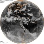
It has been 40 years ago at this very moment that Hurricane Alicia ravaged Southeast Texas, centered in the Houston metropolitan area. Hurricane Alicia came during the Cold War between America and Soviet Union. The Cold War ended in 1991 and underwent change. The world changed with 9/11 and COVID Pandemic.

The winter of 1982-1983 was an extremely strong El Nino. It was the strongest prior to winter of 1997-1998. It is one reason why 1983 Hurricane Season was inactive because the Pacific was coming off of a strong El Nino. There was a tornado outbreak in the early morning hours of May 20, 1983. It would be the last major tornado outbreak in the Houston area until November 21, 1992. Summer of 1983 was a wet one. In early August, an unusual cold front passes Southeast Texas, setting off thunderstorms as warm and moist air clashes with cool and drier air. Once the cold front is over the Gulf of Mexico, a mesoscale convective system (MCS) forms near the coast of Alabama and Mississippi on August 14th. A MCS is a large area of thunderstorms with a center of low pressure.

The area of thunderstorms continues to persist that a low pressure system forms on August 15th. By 7:00 AM CST, the area of thunderstorms became Tropical Depression 3. It is unusual to see a tropical cyclone development from a frontal boundary in August. It is more likely to do so early or late in the season because cold fronts usually do not go into the Gulf of Mexico. Later that day, Tropical Depression 3 became Tropical Storm Alicia with 50 mph winds. It was strengthening due to favorable conditions. Also, Alicia was a relatively small storm and was in an area of higher ambient pressure. Alicia was moving slowly to the west-northwest towards Texas.

On August 17th, Alicia becomes the first hurricane of the 1983 season. It is slowly moving south-southwest of Galveston. Galveston has been hit by hurricanes in the past. It is also where the deadliest hurricane and natural disaster in American history, the Great Galveston Hurricane of 1900. It made landfall southwest of Galveston on September 8, 1900. It claimed 12,000 lives, which is more lives lost than the 1906 San Francisco Earthquake (6,000), September 11, 2001 Terrorist Attacks (3,000), and Hurricane Katrina (1,836) combined.

What is Galveston doing to prepare for the onslaught of Alicia? They are ordering people to evacuate and take cover on high ground. They evacuate to avoid storm surge produced by the hurricane. Before hand, when the National Hurricane Center (NHC) were issuing gale warnings and they were not taken seriously. Galveston Mayor E. Gus Manuel ordered an evacuation on storm surge vulnerable areas. Conditions begin to worsen in Galveston. By midnight of August 18th, Mayor Manuel orders a mandatory evacuation, which is by than too late. Bridges are inaccessible due to deteriorating weather condition in Galveston.

Alicia undergoes rapid intensification and becomes the first and only major hurricane of the 1983 season. It is getting ever so closer to Galveston. Waves are getting larger, storm surge is getting higher, wind is getting stronger, and rain is getting heavier. Alicia is getting close to make landfall. People who are trying to evacuate are realizing they made a huge mistake. Their complacency proved to be a decision they would regret. The last time, an evacuation was called was in August 1980 when Hurricane Allen was in the Gulf of Mexico. Allen was a Category 5 hurricane before it made landfall as a Category 3 hurricane in South Texas. Galvestonians thought they dodged a bullet again. They were proven very wrong. In some cases, it proved deadly.

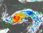
A little after 1:00 AM, Alicia made landfall southwest of Galveston as a major hurricane. Galveston was getting hammered with strong winds, heavy rain, and storm surge. At landfall, Alicia was slightly larger than average. It had gale force winds extending up to 125 miles and hurricane force winds extending up to 60 miles from the eye. Alicia was not done with Texas. It was moving to the northwest towards the city of Houston. Everyone in Houston had hunkered down for Alicia. It was a very long night.

As Alicia moved further inland, it was weakening, but it did little to quell the fears of Houstonians. Houston was getting violently lashed by Alicia with heavy rain and strong winds. To make matter worse, tornadoes were spawned by Alicia. An area from Hobby Airport to Galveston were hammered by tornadoes. Power lines and transformers were getting blown away. Power outages were wide spread throughout the Houston area. By the time Alicia was over Downtown Houston, it had weakened to a borderline Tropical Storm/Category 1 hurricane. However, the winds were lashing Downtown Houston. The strong winds turned pebbles into bullets, which were on roofs of these at the time new skyscrapers. The pebbles damaged many windows on those downtown buildings. As Alicia progressed, it was weakening into a tropical storm and dumping heavy rain. There was widespread flooding in Southeast Texas from Alicia’s heavy rain. Many areas in the Houston area saw 6 to 10 inches of rain with isolated totals of 11 inches. This is flooding on top of storm surge that flooded coastal areas.

The next morning, people woke up to widespread damage from Alicia. Trees were knocked down, damaging houses, flooding streets, and no power. People are wondering what to do next, rebuild or not. To make matters worse, 21 people died from Alicia. All in all, Alicia did $2.6 billion dollars in damage, making it at the time, the most costliest hurricane in Texas. The name Alicia would be retired from the hurricane name list and be replaced with the name Allison.

Allison was first used in 1989 and it ravages Southeast Texas in the form of a tropical storm that dumps heavy rain. Also, it would ravage Central Louisiana, giving them record rainfall. However, that would not be the last time, Allison would visit Texas. In June of 2001, Tropical Storm Allison visits again and this time it proved to be catastrophic on June 8-9, 2001. Allison dumps extremely heavy rain over Houston and causes $5.5 billion in damages and claims 22 lives. As a result, Allison was retired and replaced with the name, Andrea.

Alicia would not be the last catastrophic hurricane to visit Houston-Galveston area. On September 13, 2008, Ike made landfall on Galveston. Ike was not as strong as Alicia in terms of wind, but was much larger, on the scale of Carla (1961) or Katrina (2005). Ike was extremely catastrophic for Texas and Louisiana, that it is the third most costliest hurricane, only Katrina and Sandy exceed Ike. 84 people in Texas lost their life from Ike and did a total of $37.5 billion in damages basin wide. Hurricane Harvey paid a visit to Texas in August 2017. Harvey dumped heavy rain over a large area. Many areas in Texas and Louisiana had 30 to 40 inches with amounts as high as 80 inches of rain! Harvey claimed a total of 103 lives and did $125 billion in damages. Harvey ties with Katrina as the costliest hurricane in America as of 2023.

NHC-Hurricane Alicia Preliminary Report
Committee On Natural Disasters Hurricane Alicia
Weather Prediction Center-Hurricane Alicia

Galveston, 120 Years Ago

Let’s take a moment to reflect what happened on this very day on September 8, 1900. It comes at a time during the COVID-19 pandemic ravaging the world.

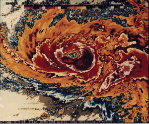
Tonight at this very moment 120 years ago, strong winds, heavy rain, and storm surge are ravaging Galveston. A large Category 4 hurricane is over Southeast Texas. Many people are still in Galveston because the Weather Bureau ignored the storm that rapidly intensified in the Gulf of Mexico south of Louisiana. The Cuban forecasters forecasted the tropical storm, which was over them will make landfall on Texas. The Weather Bureau ignored what the Cuban forecasters had said. As a result, nobody evacuates despite dark clouds rolling in and wind getting stronger by the hour.

The streets start flooding as storms clouds roll in as the weather is getting worse. As the night progresses, the winds get stronger, the rains heavier, and storm surge gets higher. Many people have not evacuated to the mainland thinking the hurricane will not hit them. Water rises rapidly as the hurricane is about to make landfall. It makes landfall near Freeport around 8:00 PM as the Full Moon is rising.

The storm surge destroys many buildings. Many are swept off their foundation with people inside. Many are washed away from the monster storm surge. Some cling on debris just to survive as there is howling winds and heavy rain. Any debris can be a deadly projectile as winds are well over 120 mph with gusts of 180 mph. The storm surge and waves destroy bridges and telegraph lines that connect Galveston to the world.

The next morning, Galveston is obliterated. Almost every building is destroyed by monster storm surge and strong wind. The hurricane produced monsterous 15 feet storm surge. The hurricane claims many lives. It ultimately claims 12,000 lives and is America’s deadliest natural or any disaster. Even to this very day, it remains the deadliest natural or any disaster in American history.

Top 10 Deadliest Disasters In America. The list excludes droughts, epidemics, and wars.
1.) 1900 Galveston Hurricane September 8, 1900 12,000
2.) 1906 San Francisco Earthquake April 18, 1906 6,000
3.) 1899 San Ciriaco Hurricane August 8, 1899 3,389
4.) 9/11 Terrorist Attacks September 11, 2001 3,000
5.) Hurricane Maria September 20, 2017 2,982
6.) 1928 Okeechobee Hurricane September 13 and 16, 1928 +2,823
7.) Pearl Harbor Attack December 7, 1941 2,466
8.) Johnstown Flood May 31, 1889 2,209
9.) 1893 Cheniere Caminada Hurricane October 2, 1893 2,000
10.) Hurricane Katrina August 29, 2005 1,833

It is also the Atlantic’s deadliest hurricane. It is only eclipsed by the Great Hurricane of 1780 and Mitch in 1998.

Irma Ravages Florida Part 2

The National Hurricane Center (NHC) has Hurricane Irma is near Tampa and it is a Category 2 hurricane with 100 mph 160 km/h 87 knot winds, which is on land 85 mph 136 km/h 74 knots. Gusts are as high as 128 mph 205 km/h 111 knots. Hurricane force winds are up to 150 miles 240 km 130 nautical miles across from northeast to southeast quadrant. Tropical force winds are up to 690 miles 1,104 km 600 nautical miles across from northwest to northeast quadrant. It is a large hurricane!

Tropical storm force winds are engulfing a large portion of Florida. It is even felt in Georgia and South Carolina! That is how large Irma is. Irma got large because it is over land, which disrupts the core. There is also a cold front. Those two make Irma larger as energy is spread out. The same reason why Ike got larger before making landfall on Texas in 2008.

Irma continues to get closer to Tampa. Here is the forecast model of where Irma will go. This is the latest heat map from various forecast models and GFS ensemble track guidance for Irma. The GFS goes up to 10 days.

Interesting to note there is not much of a consensus of where Irma will go. Interestingly, there appears to be some cluster where Irma will go in the next five days. Looks like Irma may end up over Tennessee, Kentucky, Mississippi, Alabama, Arkansas, Indiana, and Illinois.

Here is what I think will happen.
-Tampa Bay Area will be ravaged by Irma.
-Storm surge and strong winds will be the main issue.
-Flooding from storm surge and heavy rain will be widespread.

The forecast models came from NCAR-Tropical Cyclone Guidance and National Hurricane Center, . Special thanks to all of them.

Irma Ravages Florida

Hurricane Irma made landfall made landfall on Cudjoe Key, Florida as a Category 4 hurricane with 929 millibars. It is moving north at 9 mph. Irma is a very large hurricane.

The Southeast Doppler mosaic has Irma engulfing a large portion of Florida. Many areas are getting heavy rain and strong winds. Hurricane force winds are up to 138 miles 221 km 120 nautical miles across from northwest to northeast quadrant and northeast to southeast quadrant. Tropical force winds are up to 437 miles 699 km 380 nautical miles across from northwest to northeast quadrant. Irma has gotten larger, which is a bad thing.

Hurricane force winds are felt in Southern Florida from Monroe, Miami-Dade, and Collier County. Many areas are reporting hurricane force winds. A crane had collapsed in Miami and storm surge is higher than forecasted. This is despite the fact that Irma is west of the area. This puts Miami over the dirty side. This leads to the next question, where does Irma go? Here is the forecast model of where Irma will go. This is the latest heat map from various forecast models and GFS ensemble track guidance for Irma. The GFS goes up to 10 days.

The first one I will show is for Florida. It has Irma going on the western wide of Florida. It could go over the Gulf of Mexico and west or east of Tampa Bay. Tampa Bay is one of the high risk area for storm surge due to its geography. Storm surge ravaging Tampa Bay would be worse than Katrina ravaging New Orleans and Mississippi or Sandy ravaging New York City area. You did not misread it. Tampa Bay is the worst for storm surge. Irma could go near Tampa Bay and this would be very bad.

The second one is where Irma goes once inland. There is a hot spot over Tennessee and Kentucky. This suggest that Irma may end up over that region. From there, it could east or northeast. Heavy rain will be the main problem inland depending on how fast Irma moves. The slower Irma moves, more chance for heavy rain.

Here is what I think will happen.
-Irma is going to ravage Florida.
-Storm surge and high waves will be a problem on the coast.
-Tampa Bay Area could get the brunt of Irma.

The forecast models came from NCAR-Tropical Cyclone Guidance, National Hurricane Center, , and National Weather Service. Special thanks to all of them.

Irma Getting Ever So Closer

Hurricane Irma is formidable Category 3 hurricane with 125 mph 200 km/h 109 knot winds. It has a central pressure of 933 millibars. It is moving slowly west at 9 mph. Irma should turn northward later tonight. South Florida and Florida Keys are feeling the affects of Irma.

There are feeder bands pelting South Florida with heavy rain and tropical storm force winds. Irma is a large hurricane despite weakening to Category 3.

Cuba is still experiencing hurricane force winds. Hurricane force winds are up to 138 miles 221 km 120 nautical miles across from northwest to northeast quadrant and northeast to southeast quadrant. Tropical force winds are up to 380 miles 608 km 330 nautical miles across from northwest to northeast quadrant. This makes Irma a large hurricane, which in itself is dangerous regardless of Category 3 or 5. Why large hurricanes are dangerous?

Storm surge is the problem. Larger hurricanes produce higher storm surge. Let me repeat these hurricanes that were large. Hurricane Katrina in 2005. Katrina made landfall as Category 3 on Louisiana and Mississippi. It produced storm surge as high as 35 feet/10.7 meters! By comparison, Hurricane Camille made landfall in 1969 in the same area as a Category 5 hurricane, but produced storm surge of 25 feet/7.6 meters. Camille was smaller than Katrina. Hurricane Ike is another example of a large hurricane, which made landfall on Texas as a Category 2 hurricane in 2008. Ike produce storm surge as high as 25 feet/7.6 meters, which is highest outside of Mississippi! Hurricane Sandy made landfall as a Category 1 hurricane on New Jersey in 2012. It produced storm surge as high as 15 feet/4.6 meters.

Many areas in Florida will see storm surge as high as 15 feet/4.6 meters. This type of storm surge is dangerous. The land will be inundated with 3 feet/0.9 meters or greater. That amount of water rushing in is dangerous and will wash anyone away! Anyone who lives in storm surge areas need to evacuate! If you live in an area with no storm surge, you should hide, with the exception living in a mobile home. Case in point, too many people evacuated when Hurricane Rita came barreling towards Texas and Louisiana. Most people who evacuated did not need to evacuate. This came a month after Katrina ravaged Louisiana and Mississippi. Also, more people died while evacuating than in the actual hurricane. We are seeing that problem with Florida. People who really need to evacuate are people who live in storm surge prone areas.

Here is the forecast model of where Irma will go. This is the latest heat map from various forecast models and GFS ensemble track guidance for Irma. The GFS goes up to 10 days.

Most have Irma going northwards towards Florida. It could go west of Florida or over Miami area. Either way, it is going to be bad for Florida. Once Irma is inland, most forecast models have Irma over Tennessee and Kentucky. This could be an issue as hurricanes weaken and go inland, they can dump heavy rain, especially at night. The heavy rains often fall at night near the center of the warm core low. These thunderstorms converge closer to the center at night as the low pressure system is warm core and the ambient temperature is cooler. They are called core rain. Hurricane Harvey is a tragic example of core rains that led to massive flooding in Southeast Texas including Houston. The forecast model is five days, so anything can change now and tomorrow.

Here is the most recent intensity forecast. The intensity forecast model for Irma are all over the place.

Some keep Irma as a Category 3 hurricane, while others have Irma intensifying into Category 4. I would not be surprised if Irma intensifies to Category 4 or even 5 prior to landfall on Florida. Regardless, Irma is going to be a very dangerous hurricane. A weakening hurricane can be more dangerous because people think if it weakens, than they should be safe. Hurricanes that weaken are due to land interaction or eyewall replacement cycle. Those two can cause hurricanes to get larger. Also, once eyewall replacement cycle is done, the hurricane gets larger and stronger.

The wind radii gets larger in part due to land interaction and eyewall replacement cycle as Irma gets closer to Florida. This is why I keep saying larger hurricanes are dangerous regardless of Category 3 or 5. Here is a rainfall forecast model ending at September 16, 2017 at 7:00 PM. They are from GFS, EURO, Canadian, and Weather Prediction Center (WPC).

All are in agreement that Florida will get heavy rain from Irma. GFS and WPC have the heavy rain over the middle of Florida. EURO has the heavy rain over the western part of Florida. The Canadian has heavy rain over eastern part of Florida. The GFS has the heaviest amount of up to 35.2 inches/89.4 centimeters of rain. It is south of the Florida Keys. The EURO has 17.9 inches/45.5 centimeters of rain, which is also south of the Florida Keys. Most areas should see 8 to 12 inches/20.3 to 30.5 centimeters of rain from Irma.

Here is what I think will happen.
-Irma could affect Florida as early as tomorrow morning.
-Storm surge and high waves will be a problem on the coast.
-Strong winds and heavy rain will be the main problem inland.

The forecast models came from NCAR-Tropical Cyclone Guidance, National Hurricane Center, Weather.US, Weather Prediction Center (WPC), and NWS Key West. Special thanks to all of them.

It is going to be a long night and day for Florida. Let’s hope everyone is hunkered down in areas that have no storm surge. Anyone who is storm surge prone areas are away. This could be bad for Florida.

Triple Threats

Cuba is about to get hit by formidable Category 5 monster, Hurricane Irma from National Hurricane Center (NHC). It has 160 mph 256 km/h 139 knot winds and central pressure of 924 millibars. Irma is getting close to making landfall on Camagüey Archipelago, Cuba. The last time a Category 5 hurricane made landfall on Cuba was 1924 Cuba Hurricane, which made landfall on Western Cuba. It is going to be a very long and frightening night. Many people in Irma’s path will experience strong winds of 80 to 120 mph 128 to 192 km/h 70 to 104 knots with gust as high as 120 to 180 mph 192 to 288 km/h 104 to 156 knots. They can see heavy rain with amounts of 10 to 15 inches/25.4 to 38.1 centimeters with totals as high as 30 inches/76.2 centimeters. Storm surge could go as high as 10 feet/3.04 meters! This is not a storm to mess with. Parts of Cuba are experiencing hurricane force winds.

Irma is a large hurricane with hurricane force winds that is 138 miles 221 km 120 nautical miles across northeast to northwest quadrant and northeast to southeast quadrant. Tropical storm force winds that are 357 miles 571 km 310 nautical miles across northeast to northwest quadrant. Hurricane force winds could last up to 10 hours in Cuba. There is going to be a lot of damage by tomorrow. Let’s look at intensity forecast.

Most forecast models keep Irma as a Category 5 hurricane for the next 36 hours. Some weaken it within 24 hours. I think Irma will be a Category 5 prior to affecting Florida. Where does Irma go after Cuba is a frightening prospect. Here is the latest heat map from various forecast models and GFS ensemble track guidance for Irma. The GFS goes up to 10 days.

The models are trending westward, which means Irma could go west of Miami area. That is actually worse because it puts the dirty side of Irma over Miami area. They get strong winds, heavy rain, storm surge, and high waves. It looks to be traversing over Florida. That is a very horrifying prospect as it could ravage a large portion of the state. This includes Naples, Orlando, Tampa, and St. Petersburg. As Irma gets closer to Florida, it is looking to get larger.

The NHC forecasts Irma gets larger, which makes it more dangerous regardless of Category 4 or 5. Larger hurricanes produce higher storm surges and waves on top of prolonged heavy rain. Here is a rainfall forecast model ending at September 11, 2017 at 10:00 PM. They are from GFS, Canadian, EURO, and Weather Prediction Center (WPC).

All the forecast models are in agreement that Florida will get heavy rain from Hurricane Irma. However, the forecast models vary in location. The GFS and WPC are in the middle of Florida, while EURO has it more rain to the west. The Canadian has it more to the east. Most agree that Florida could see 8 to 12 inches/20.3 to 30.5 centimeters of rain. Some areas could see as much as 20 inches/50.8 centimeters of rain. The widespread heavy rain can lead to flooding in Florida, which is very serious, especially in light of Harvey over Texas.

There are two hurricanes, Jose and Katia. Let’s start with Jose. Jose is now a strong Category 4 hurricane with 155 mph 248 km/h 135 knots. I would not be surprised if Jose does get upgraded to Category 5. There are Hurricane Warnings for hurricane ravaged Barbuda and Anguilla, Sint Maarten, St. Martin, St. Barthelemy. The forecast model is from various forecast models and GFS ensemble track guidance for Irma. The GFS goes up to 10 days. It looks that Jose may affect those ravaged islands. Let’s hope Jose stays very faraway from them. They do not need a second hurricane to hit them.

One difference between Jose and Irma is that Jose is not as large as Irma.

It more the size of Hurricane Harvey prior to landfall on Texas. The size certainly helped Jose undergo rapid intensification. Let’s take a look at the intensity forecast.

The intensity forecast model for Jose is to weaken. One forecast model has Jose becoming a Category 5 hurricane in 72 hours. I would not be surprised if Jose becomes a Category 5 hurricane or is one, but was not measured.

Another hurricane just made landfall north of Tecolutla, Veracruz, Mexico, Hurricane Katia. It was the area of thunderstorms that was watched after Harvey flooded out Texas. It made landfall earlier tonight. Currently Katia has 75 mph 120 km/h 65 knots wind. It is a small hurricane.

Hurricane force winds in Katia from northeast to southeast quadrant is 29 miles across, while tropical storm force winds from northeast to southeast quadrant is 120 miles across. Most forecast models have Katia going over Mexico, which becomes more of a heavy rain and flood event. Some areas could see up to 30 inches/76.2 centimeters of rain, especially in the mountains.

Here is what I think will happen.
-Irma could affect Florida this weekend.
-Jose could affect Irma ravaged Antigua, Barbuda, Anguilla, Sint Maarten, and St. Martin.

The forecast models came from NCAR-Tropical Cyclone Guidance, National Hurricane Center, Weather.US, Weather Prediction Center (WPC), and National Weather Service. Special thanks to all of them.

This could a very bad event for Florida. This is the most frightening hurricane since Katrina was approaching Louisiana and Mississippi, Ike approaching Texas, or Harvey approaching Texas. I am very concerned for Florida. They better be super prepared.

Tres Huracanes

It is going to be a long night for Grand Inagua in the Bahamas. They are getting pelted by strong winds, heavy rain, high waves, and deadly storm surge. Irma has maximum sustained winds of 165 mph 264 km/h 144 knots with gusts as high as 235 mph 376 km/h 204 knots.

The central pressure is 920 millibars, which has risen. This is due to eyewall replacement cycle. Once it is done, Irma would get larger and stronger, which is worse. The update is from National Hurricane Center (NHC).

Irma is quite a large hurricane. The whole Bahamas is going to be ravaged by Hurricane Irma. The Bahamas could see storm surge of up to 20 feet/6.1 meters or greater. Bahamas is mostly flat. So anyone there should seek higher ground now!

The satellite image is quite impressive. I would not want to be caught under Irma right now. The question now is where does Irma go. Here is the latest heat map from various forecast models and GFS ensemble track guidance for Irma. The GFS goes up to 10 days.

The forecast models have Irma going west-northwest. It could make landfall or not on Cuba and than turn north into Florida. The question is where would Irma make landfall. If it makes landfall around Florida Keys or near Miami, it will be really bad. If Irma traverses over Florida, it would ravage Florida with strong winds, heavy rain, high waves, and deadly storm surge. That would be really bad. Another scenario is Irma stays offshore of Florida and makes landfall on Georgia or South Carolina. These are all just scenarios for Florida. The forecasts models are in consensus that Florida could be affected by Irma over the weekend. Anyone who is living in evacuation zones need to evacuate now! This is no game! Unfortunately, many cannot escape as gasoline has ran out at many gas stations. They would have to go another gas station and that is no picnic for sure. Waiting in long lines to get gasoline.

Since Irma has been a Category 5 hurricane since Tuesday, will Irma be still a Category 5 hurricane by this weekend?

Most forecast model keep Irma as a Category 5 by tomorrow. Some weaken it to Category 4 in 24 hours. Most keep Irma as a Category 5 for 36 hours. I think Irma will remain a Category 5 hurricane as it gets closer to Cuba and Florida. Here is why I think this.

The waters ahead of Hurricane Irma are very warm and deep. They have lots of energy for Irma to feed off of. The deep warm water is more favorable for maintaining and intensifying Irma. We have a long way to go when it comes to intensity forecast. Even if Irma weakens to Category 4, the NHC forecasts Irma becomes a much larger hurricane, which makes it more dangerous.

The warm waters can make Irma larger as it undergoes eyewall replacement cycle. A larger Hurricane Irma, even as Category 3 or 4 is very dangerous because it can produce higher storm surge and waves. Case in point, Hurricane Katrina in 2005. Katrina made landfall as Category 3 on Louisiana and Mississippi. It produced storm surge as high as 35 feet/10.7 meters! Hurricane Camille made landfall in the same area as a Category 5 hurricane, but produced storm surge of 25 feet/7.6 meters. Camille was smaller than Katrina. Hurricane Ike is another example of a large hurricane, which made landfall on Texas as a Category 2 hurricane in 2008. Ike produce storm surge as high as 25 feet/7.6 meters, which is highest outside of Mississippi! Hurricane Sandy made landfall as a Category 1 hurricane on New Jersey in 2012. It produced storm surge as high as 15 feet/4.6 meters.

If Irma is the only threat in the Atlantic, there is also Jose and Katia. Let’s start with Jose. Jose is now a major hurricane with 120 mph 192 km/h 105 knots with gusts as high as 150 mph 240 km/h 130 knots.

The forecast model is concerning as that Jose could affect the same areas ravaged by Irma. There is a Hurricane Watch for Antigua, Barbuda, Anguilla, Sint Maarten, and St. Martin. They have been utterly leveled by Irma. Jose would make things worse as they already are. Here is the intensity forecast model for Jose.

Some of the forecast models have Jose becoming a Category 4 hurricane. I think Jose has a chance at being a Category 4 hurricane by tomorrow. It is far away from Irma to not be affected.

Closer to Texas, there is Hurricane Katia in the Southern Gulf of Mexico. Katia is a Category 1 hurricane with 85 mph 136 km/h 74 knots winds with gusts as high as 106 mph 170 km/h 92 knots. Here is a forecast model for Katia.

Most of the forecast models have Katia going towards Mexico. It is unlikely that Katia will turn northwards towards flood ravaged Texas. That is a good thing for sure. The next question is how strong will Katia get?

Only one forecast model has Katia as a Category 3 hurricane, which would be the fourth major hurricane in 2017. Most have Katia peaking at Category 2. I think it has a chance of being a Category 3 hurricane. The area where Katia is over is warm, so it could further intensify. It is also a small hurricane, so it can intensify more quickly.

This is an ever changing event. The forecast is subject to change. Regardless, be prepared!

Here is what I think will happen.
-Irma could affect Florida this weekend
-Jose could pose a threat to Irma ravaged Antigua, Barbuda, Anguilla, Sint Maarten, and St. Martin.
-Katia will make landfall on Mexico.

The forecast models came from NCAR-Tropical Cyclone Guidance, National Hurricane Center, and Tropical Cyclone Heat Potential. Special thanks to all of them.

The Three Hurricanes

Irma is a very formidable hurricane that is ravaging the Windward Islands and Lesser Antilles. Many buildings are destroyed and areas are flooded from the monster hurricane. Barbuda and Barbados are utterly leveled. Jose and Katia are now hurricanes. We have three hurricanes in the Atlantic at once. The last time that happened was in September 2010 with Igor, Julia, and Karl in September 2010. There were four hurricanes at once in September 1998; Georges, Ivan, Jeanne and Karl. In August 1893, there were four hurricanes active. This is a really active pattern we are in.

That infrared satellite image is over Barbuda, which has been really devastated by Irma. I can imagine the death toll could be quite horrendous.

Here is the latest heat map from various forecast models and GFS ensemble track guidance for Irma, Katia, and Jose. The GFS goes up to 10 days. Let’s start with Irma as it is the most dangerous.

The forecast has Irma moving west-northwest. across the Atlantic. It looks more likely Irma is going to hit Florida. An area of major concern is the Miami area. It is a large urban area with many buildings and buildings under construction. If Irma hit Miami area directly, it is going to be really bad. It could be more damaging that Katrina or even Harvey! It looks like Irma may go towards Georgia, South Carolina, and North Carolina, which is too early to tell.

Irma remains a dangerous Category 5 hurricane with 185 mph 296 km/h 161 knots hurricane. It has gusts of 235 mph 376 km/h 204 knots. The central pressure has dropped to 914 millibars. No hurricane in the Atlantic has maintained 180 mph 288 km/h 157 knots for that long! This is really telling!

The intensity forecast model keeps Irma as a Category 5 hurricane and weakens within 36 hours. Intensity forecasting is not that accurate as we have a long way to go. I would not be surprised if Irma becomes stronger with 190 mph 304 km/h 165 knot winds or greater! The central pressure is at its lowest as of right now.

Here is Hurricane Jose.

Jose looks to be a fish storm. However, I could not rule out another landfall after Irma, but that is too early to tell right now. Looking at Jose, I think it has a chance of being our next major hurricane.

Some of the forecast models have Jose as a major hurricane in the next 2 days. I think it could be a major hurricane as early as tomorrow.

Lastly, there is Katia.

The current forecast models have Katia making landfall on Mexico. The chance of Katia going northward towards Texas is low at this time. That is a good thing as they are still reeling from Harvey.

Most forecast models have Katia intensifying. A couple of them have Katia becoming a major hurricane in 36 hours. Again, I would not be surprised if Katia became a major hurricane as well. The Bay of Campeche is favorable for hurricanes to undergo rapid intensification.

Let’s go back to Irma. Currently, Irma is north of Puerto Rico. Here is the most recent Doppler radar from San Juan.

This is what a Category 5 monster looks like on Doppler radar. Despite being north of the island, the weather is really bad right now. Puerto Rico is experiencing tropical storm force winds with occasional hurricane force gusts.

The one hour rainfall totals are nothing short of impressive.

The southern eyewall have extremely heavy rain. Doppler radar estimates up to 8 inches/20.3 centimeters per hour! That is some intense stuff right there!

All forecast models are subject to change.

Here is what I think will happen.
-Irma will maintain and may get stronger.
-Dominican Republic, Haiti, and Cuba could be effected. Would not rule out a landfall.
-Bahamas could be next before Florida.
-Florida better prepare for Irma.

Everyone in Irma’s path better be super prepared for this. Irma is one vicious hurricane.

The forecast models came from NCAR-Tropical Cyclone Guidance, National Hurricane Center, and NWS San Juan. Special thanks to all of them.

Incredible Irma

Hurricane Irma is now a powerful Category 5 hurricane with 185 mph 296 km/h 161 knots hurricane. It has gusts of 235 mph 376 km/h 204 knots. It has a central pressure of 916 millibars. This is a very dangerous hurricane. Here is an infrared satellite up close of Irma.

Very impressive and scary I will say. Here is a wind radii map of Irma.

Hurricane force winds extend up to 50 miles 80 km/h 44 nautical miles. Tropical Storm force winds extend up to 175 miles 280 km/h 152 nautical miles. It is a fairly large hurricane. Antigua and Barbuda, Guadeloupe, and St. Kitts Nevis are experiencing tropical storm force winds. They could get hurricane force winds later tonight. It is going to be a very long night for them. If Irma makes landfall at its current strength, it would be one of the strongest tropical cyclones to make landfall in terms of wind. Antigua and Barbuda, Guadeloupe, and St. Kitts Nevis could see winds of 180 mph 288 km/h 157 knots with gusts as high as 270 mph 432 km/h 235 knots! The winds are enough to flatten buildings! There is also deadly storm surge and high waves battering the island. It is going to be really rough for them. Let’s hope they are prepared.

The latest Doppler radar shows that there is light rain right now. It is from Meteo-France and out of Guadeloupe and Martinique.

It shows the western eyewall, which could affect them later tonight. The eastern eyewall has the strongest winds and that could come while they sleep. It is going to be a nightmare for them.

Where does Irma go? Here is the latest heat map from various forecast models and GFS ensemble track guidance. The GFS goes up to 10 days.

The forecast models have going west-northwest towards Virgin Islands and Puerto Rico. From there, Irma could make landfall on Dominican Republic, Haiti, and Cuba. From there, Irma may hit Florida. Where it goes is anyone’s guess. The heat map generally shows once Irma reaches Florida, it goes northward. Keep in mind, this is 5 days away. The heat map shows a low chance that Irma may end up in the Gulf of Mexico. The reason the forecast has Irma going north is a cold front. The cold front is a major factor on where Irma will go. Keep in mind anything can happen and forecast is subject to change.

One wonders how long can Irma be a Category 5 hurricane. Category 5 hurricanes do not last long.

The forecast model keep Irma as a Category 5 hurricane for another 48 hours. If Irma is a Category 5 hurricane for that long, it would be the longest lived Category 5 hurricane. It would be the longest since Ivan in 2004. It may even exceed Ivan and challenge Allen in 1980 or 1932 Cuba Hurricane. That is very telling! Most forecast models have Irma weakening into a Category 4 hurricane, which is still extremely dangerous. However, intensity forecast models are not that reliable. I think Irma could still be a Category 5 hurricane by tomorrow and towards Florida. Again, anything can change.

Antigua, Barbados, Guadeloupe, and St. Kitts Nevis are going to have a long night tonight. Howling winds, heavy rain, high waves, and deadly storm surge are going to be very violent. They could see 8 to 12 inches/20.3 to 30.5 centimeters of rain with amount as high as 20 inches/50.8 centimeters.

Here is what I think will happen.
-Irma will maintain and may get stronger.
-The next morning will be horrible for Antigua, Barbados, Guadeloupe, and St. Kitts Nevis.

The forecast models came from NCAR-Tropical Cyclone Guidance, National Hurricane Center, and Meteo-France. Special thanks to all of them.

A New Normal Part 2

We are living in a new world and reality, a post-Harvey Texas. Just a week ago, a Category 4 monster, Hurricane Harvey was barreling down towards Rockport. Harvey was the first major hurricane to make landfall on America since Wilma in 2005. I think the National Hurricane Center (NHC) may increase Harvey’s peak to 140 mph 224 km/h 122 knots hurricane. Harvey being the first major hurricane to make landfall since Wilma has been largely overshadowed by the epic flooding that ravaged Houston and Beaumont area. That started on the night of August 26, 2017. A series of core rains that form near the center of Harvey.

One good news, the area of thunderstorms in the Southwest Gulf of Mexico does not pose a threat due to wind shear. It is an area of thunderstorms from a tropical wave. However, a cold front that is passing to Southeast Texas could set off thunderstorms and more rain as it picks up moisture from the tropical wave per NWS Houston.

000
FXUS64 KHGX 020220
AFDHGX

Area Forecast Discussion
National Weather Service Houston/Galveston TX
920 PM CDT Fri Sep 1 2017

.UPDATE...
Forecast for tonight looking on track. Updated temps and
dewpoints for trends.

Beat

&&

.PREV DISCUSSION... /ISSUED 628 PM CDT Fri Sep 1 2017/

AVIATION...
Sea breeze and outflow boundary are working their way inland with not
a whole lot of wind changes. SHRA activity that did develop late this
afternoon has now moved away from LBX. Look for light and variable
winds overnight with some patchy MVFR fog possible again at CXO. Expect
VFR conditions tomorrow with mainly light and variable winds. 42

PREV DISCUSSION... /ISSUED 343 PM CDT Fri Sep 1 2017/

DISCUSSION...
Current satellite is showing the typical afternoon cumulus field
developing across southeast Texas. There is a little enhanced
cumulus along the coast but the weak seabreeze is having trouble
generating enough lift for anything more than very isolated and
weak showers. This is expected again tomorrow and the dry weather
is greatly appreciated.

Models are still showing an upper level trough dropping into North
Texas tomorrow night though a significant change is a stronger
ridge over the southern Plains pinching the trough off from the
westerly flow and retrograding it back to the southwest earlier
than previous model runs. A more westerly position of this trough
means weaker lift and lower PoPs for Saturday night and Sunday.

Tropical moisture in the southern Gulf of Mexico will move north
early next week giving us our next decent chance for rainfall. At
the same time, a western U.S. ridge will amplify and northerly
upper flow will drive a cold front through the area Tuesday night
and early Wednesday. The tropical moisture already in place will
interact with this cold front producing a line of showers and
storms along the front. Fortunately the cold front will be moving
fairly quickly, especially for this time of year, pushing the rain
south by Wednesday afternoon. Behind the front, cool and dry air
will filter into the area bringing very pleasant temperatures with
highs only in the lower 80s Wed/Thu.

Hennig

There is also a tropical wave in the far eastern Atlantic that has a good chance of becoming Jose in the next five days. My main concern is Hurricane Irma, which is a Category 3 hurricane out in the Atlantic. Many are wondering where will Irma go. The latest heat map from various forecast models and GFS ensemble track guidance. The GFS goes up to 10 days.

Most forecast models have Irma moving west southwest direction in the next 5 days. From there, based on GFS ensembles, it could go anywhere. Some have Irma going into the Gulf of Mexico and hitting Louisiana in 10 days. Some have Irma hitting Florida to New York. This is too early too tell and this a low confidence forecast. Anything can happen between now and around September 11, which is the 16th anniversary of horrifying terrorist attacks that killed 3,000 people and destroyed the World Trade Center.

Many on social media may have seen this.

That is bogus. For one, the NHC does not issue forecasts 13 days in advance. They only go up to 5 days in advance. Nobody knows where Irma or any hurricane will go in the next 10 days, let alone 5 days.

The latest intensity forecast are in general agreement that Irma will be a major hurricane. A couple have Irma as a Category 2 fluctuating as Category 3, which happens due to eyewall replacement cycle.

I would not be surprised if Irma becomes a Category 5 hurricane, especially when it gets around the Caribbean. Hurricanes in that part of the Atlantic rarely become Category 5 hurricanes. Irma will have to be watched for September.