Hurricane Ike 15 Years Later

An original post from 2018 that is reposted and changed.

It is hard to believe it has been 15 years since Hurricane Ike made landfall on Southeast Texas as a monsterous Category 2 hurricane in the early morning hours of September 13, 2008. Between the fifteen years a lot has happened since Ike. Before Ike came crashing in, Cyclone Nargis ravaged Burma (Myanmar) and claimed over 138,000 lives. Not too long after, there is the Sichuan Earthquake that claims nearly 88,000 lives. Ike made landfall seven years after the devastating 9/11 Terrorist Attacks, which destroyed the World Trade Center and claimed nearly 3,000 lives. Ike came three years after Hurricane Katrina, Rita, and Wilma ravaged the US Coast. Four years after the Indian Ocean Tsunami that ravaged Indonesia and Thailand.

After Ike, comes the collapse of Lehman Brothers during a severe recession. There is the deadly Haitian Earthquake that claims up to 316,000 lives and the Deep Horizon Oil Spill in 2010. Japan was hit by a deadly Tsunami that led to the Fukushima Nuclear Meltdown in 2011. Harvey came and flooded out Southeast Texas with heavy rain over a large area in 2017. Then comes COVID pandemic, which started in 2019, but did not get noticed until 2020. Ukraine and Sudan are currently mired in war.

Ike pelted Southeast Texas and Southwest Louisiana with hurricane force winds and heavy rain. Ike was the last hurricane to hit Texas prior to Harvey. Almost a nine year gap of no hurricanes hitting Texas, let alone a major hurricane. The last major hurricane to hit Texas prior to Harvey was Bret in 1999, which is 18 years.

Thunderstorms over Sudan that later became Ike.

What is the origin of Hurricane Ike? Ike started as a mesoscale convective system (MCS) that formed over Sudan on August 19th. Most tropical waves come from thunderstorms that form in the Northeast part of Africa. They are set off by the Intertropical Convergence Zone (ITCZ) or monsoon. The ITCZ is where there is thunderstorms from the clash of trade winds. These thunderstorms often provide beneficial rains in tropical and subtropical areas. The thunderstorms in ITCZ can break away and travel away. One of those thunderstorms from the ITCZ managed to do that. The MCS traveled over Africa and entered the Atlantic Ocean as a tropical wave on August 29th. The tropical wave traveled across with multiple vortices competing. One of them would win out as the thunderstorms in the tropical wave get better organized on September 1, 2008. It is upgraded to Tropical Depression #9. Later that day, it is named Ike as it travels over the open Atlantic. Tropical Storm Ike has to deal with wind shear in the upper level early in its life. The wind shear blows tops of thunderstorms, especially westerly wind shear. Since 2008 season is Neutral to La Nina, conditions are more favorable as there is less westerly wind shear. If 2008 was El Nino, there would be more westerly wind shear, which is why generally El Nino Atlantic Hurricane seasons see less storms. Wind shear generally kills tropical development. The higher the storm clouds are, the cooler it is. Higher storm clouds also mean they are more intense.

However, Ike gets a reprieve as the wind shear weakens and encounter warmer waters on September 3rd. This allows Ike to rapidly intensify into a major hurricane. By the next day, Ike becomes 2008’s strongest hurricane with 145 mph 126 knots 233 km/h winds and central pressure of 935 millibars. Ike’s strength did not last as it encountered wind shear on September 5th. The wind shear weaken Ike to Category 2 strength.

Hurricane Ike around its peak.

Ike is pushed southwards into more favorable areas due to upper level ridge to the north. Ike becomes a Category 4 hurricane as conditions are more favorable. As it goes westward, Ike made its first landfall on Turks and Caicos Islands as a Category 4 hurricane on the early morning hours of September 7th. The Turks and Caicos Islands are the first to feel Ike’s violent wrath in the form of strong winds, heavy rain, storm surge, and high waves. The South Caicos and Grand Turk take the brunt of Ike. Despite Ike’s fury, there are no reports of fatalities.

Damage in Grand Turk.

While Ike is ravaging the Turks and Caicos Islands, the outer bands of Ike are dumping heavy rain on Haiti and Dominican Republic, which have been ravaged by Fay, Gustav, and Hanna. The flooding from Ike claims 74 lives in Haiti and 2 in Dominican Republic. Prior to Ike, Tropical Storm Hanna ravaged Haiti and Dominican Republic with heavy rain that led to massive flooding. The flooding claims 529 lives in Haiti, while just one dies in Dominican Republic. Why did Haiti see more fatalities than Dominican Republic? The lack of trees in Haiti makes it even more vulnerable to mudslides from the mountains. The heavy rain causes deadly mudslides that destroys houses and kill people.

Stranded Cubans following Ike.

Once Ike passes Turks and Caicos Island, Ike heads for Cuba. The hurricane makes landfall on Cabo Lucrecia, Holguín Province, Cuba. Cuba is in a very rough ride with Ike as it traverses over the entire island nation. Cuba is being pelted by heavy rain, strong wind, high waves, and storm surge. Briefly, Ike goes over the water only to make a second landfall on Punta La Capitana, Pinar del Río, Cuba on September 8th as a Category 1 hurricane. Ike claims 7 lives in Cuba.

Ike near its secondary peak in Gulf of Mexico.

Once Ike exits Cuba, it is a large Category 1 hurricane. Ike traveling over all of Cuba caused the storm to expand as energy is spread out from land interaction. It also disrupted Ike’s core. Ike enters large area of warm water in the Gulf of Mexico and is getting close to the Loop Current, which is one of the warmest spot. Ike rapidly deepen from 963 to 944 millibars on the night of September 10th as it was over the Loop Current. However, the wind did not strengthen much, only from 80 to 100 mph 70 knots to 87 knots 128 km/h to 161 km/h. The reason is Ike is a very large hurricane with hurricane force winds extending up to 125 miles 109 nautical miles 201 kilometers from the eye. The pressure gradient is not tight due to its large size. Normally, an Atlantic hurricane with central pressure of 944 millibars is a Category 3 or 4 hurricane.

On September 11th, as America remembers and reflects the seventh anniversary of the 9/11 Terrorist Attacks, Southeast Texas is sunny and dry. The west side of a hurricane in the Northern Hemisphere is usually the “clean” side. It blows in dry and sinking air from the north. The nice sunny day is very deceptive as Ike is ever inching closer. Meanwhile in the Gulf of Mexico, Ike is generating massive waves that are heading towards the Texas and Louisiana. Ike continues across the Gulf of Mexico as a large Category 2 hurricane. Waves are coming ahead of Ike in coastal Texas. People are evacuating from coastal areas including Galveston. Some choose to stay behind. The outer cloud banks of Ike are over Southeast Texas as winds start to pick up. By the afternoon of September 12th, some coastal areas are getting squally weather from the feeder bands entering Texas.

By the night of September 12th, conditions have gotten much worse. Meanwhile in Houston area, it is still windy with occasionally light rain. As the night progresses, Ike is getting closer to landfall. The hurricane force winds enter Texas around the late hours of September 12th. Ike is getting stronger and developing a more organized eyewall. Ike now has a central pressure of 951 millibars and 110 mph 96 knots 177 km/h winds. Ike is a large hurricane with hurricane force winds extending up to 125 miles and tropical storm force winds extending up to 260 miles 226 nautical miles 418 kilometers.

Ike at landfall on Southeast Texas.
Highest wind gust possible based on multiplying by factor of 1.5.

By the early morning hours of September 13th, Houston area is seeing stronger winds and heavier rain. Power starts to go out throughout Southeast Texas as power lines are being knocked by the strong wind. The coastal areas are seeing storm surge getting higher and higher. Anyone who stayed behind in Galveston or Bolivar Peninsula are doomed by the massive storm surge. Ike makes landfall on the eastern end of Galveston Island at 2:10 AM Central Time. People who are staying behind in the coastal areas are wishing they had evacuated as they are surrounded by rising storm surge. Ike travels to the northwest towards Houston. By 4:00 AM, Ike is over Baytown, which is flooded by storm surge. A large area of Southeast Texas is getting hurricane force winds including all of Houston.

Highest sustained winds during Hurricane Ike.
Bolivar Peninsula following Ike.

By the time the Sun rises, Ike is still ravaging Southeast Texas despite the fact it has weakened to Category 1 hurricane. Ike remains a monsterous and very dangerous hurricane. Many areas are still seeing heavy rain and strong winds. The wind blow down numerous trees and damage many buildings and houses. There is widespread flooding reported throughout Southeast Texas. Bayous and rivers are overflowing from widespread heavy rain. Coastal areas had storm surge as high as 25 feet/7.6 meters. It is one of the highest storm surge recorded in America and highest in Texas. It exceeds Camille, but below Katrina. Bolivar Peninsula saw the highest storm surge as the whole area looked like if a nuclear bomb had exploded. Once it is all over, many buildings and houses are damaged or destroyed, while many trees are uprooted. Coastal areas are utterly gutted from the massive storm surge. Millions of people are out of power for days. A large area saw 6 to 12 inches/15.2 to 30.5 centimeters of rain from Ike.

The damage is not just limited to Texas. Louisiana also felt the brunt of Ike, especially in Southwestern Louisiana. It is the same area that had been ravaged by Hurricane Rita in 2005. Many areas are flooded by Ike. There is even flooding in New Iberia, which is in Central Louisiana. It shows that Ike’s massive size had a huge impact over a large area from Texas to Louisiana. This is despite the fact that they only got tropical storm force winds. It shows that large, but not so strong hurricane is very dangerous as it produces massive storm surge and high waves.

Thunderstorms ahead of a cold front in the early morning hours of September 14, 2008.

The following night, a cold front passes, which allows thunderstorms to form from moisture left by Ike. The storms dumped 5 to 8 inches/12.7 to 20.3 centimeters of rain. The heavy rain causes more flooding on top of what Ike dumped in Southeast Texas. Once the rain ended, many areas saw a two day total ranging from 10 to 20 inches/25.4 to 50.8 centimeters of rain. Meanwhile, the remnants of Ike continue to wreak havoc in the Midwest. Ohio see hurricane force gusts, which causes more power outages. The remains of Ike continue into Canada and dump heavy rain in Ontario and Quebec. A total of 112 people lost their life with 34 unaccounted for in America. Most of the deaths are in Texas, where 84 people died.

Rainfall total from September 12, 2008 to September 15, 2008.

So, how was 2008 like prior to Ike. The winter of 2007-2008 is La Nina, so it is warmer and drier. Despite the La Nina, there are storms. Spring of 2008 is mostly dry. There were days of pleasant weather in Spring 2008. Summer of 2008 is average in terms of temperature and rainfall. Texas first brush with a hurricane is Dolly, which affected South Texas. The outer bands of Dolly dump heavy rain in the Houston area. Not too long after Dolly came, Tropical Storm Edouard pays a visit to Houston area. It is a rather unremarkable tropical storm that dumps up to 6 inches of rain. Edouard moves inland and gives beneficial rains to drought ridden Central Texas.

NHC Hurricane Ike Report
NHC Hurricane Ike Advisory Report
Morphed Integrated Microwave Imagery at CIMSS (MIMIC)

Hurricane Alicia, 40 Years Later

An original post from 2013 that is reposted and changed.

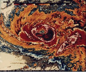
It has been 40 years ago at this very moment that Hurricane Alicia ravaged Southeast Texas, centered in the Houston metropolitan area. Hurricane Alicia came during the Cold War between America and Soviet Union. The Cold War ended in 1991 and underwent change. The world changed with 9/11 and COVID Pandemic.

The winter of 1982-1983 was an extremely strong El Nino. It was the strongest prior to winter of 1997-1998. It is one reason why 1983 Hurricane Season was inactive because the Pacific was coming off of a strong El Nino. There was a tornado outbreak in the early morning hours of May 20, 1983. It would be the last major tornado outbreak in the Houston area until November 21, 1992. Summer of 1983 was a wet one. In early August, an unusual cold front passes Southeast Texas, setting off thunderstorms as warm and moist air clashes with cool and drier air. Once the cold front is over the Gulf of Mexico, a mesoscale convective system (MCS) forms near the coast of Alabama and Mississippi on August 14th. A MCS is a large area of thunderstorms with a center of low pressure.

The area of thunderstorms continues to persist that a low pressure system forms on August 15th. By 7:00 AM CST, the area of thunderstorms became Tropical Depression 3. It is unusual to see a tropical cyclone development from a frontal boundary in August. It is more likely to do so early or late in the season because cold fronts usually do not go into the Gulf of Mexico. Later that day, Tropical Depression 3 became Tropical Storm Alicia with 50 mph winds. It was strengthening due to favorable conditions. Also, Alicia was a relatively small storm and was in an area of higher ambient pressure. Alicia was moving slowly to the west-northwest towards Texas.

On August 17th, Alicia becomes the first hurricane of the 1983 season. It is slowly moving south-southwest of Galveston. Galveston has been hit by hurricanes in the past. It is also where the deadliest hurricane and natural disaster in American history, the Great Galveston Hurricane of 1900. It made landfall southwest of Galveston on September 8, 1900. It claimed 12,000 lives, which is more lives lost than the 1906 San Francisco Earthquake (6,000), September 11, 2001 Terrorist Attacks (3,000), and Hurricane Katrina (1,836) combined.

What is Galveston doing to prepare for the onslaught of Alicia? They are ordering people to evacuate and take cover on high ground. They evacuate to avoid storm surge produced by the hurricane. Before hand, when the National Hurricane Center (NHC) were issuing gale warnings and they were not taken seriously. Galveston Mayor E. Gus Manuel ordered an evacuation on storm surge vulnerable areas. Conditions begin to worsen in Galveston. By midnight of August 18th, Mayor Manuel orders a mandatory evacuation, which is by than too late. Bridges are inaccessible due to deteriorating weather condition in Galveston.

Alicia undergoes rapid intensification and becomes the first and only major hurricane of the 1983 season. It is getting ever so closer to Galveston. Waves are getting larger, storm surge is getting higher, wind is getting stronger, and rain is getting heavier. Alicia is getting close to make landfall. People who are trying to evacuate are realizing they made a huge mistake. Their complacency proved to be a decision they would regret. The last time, an evacuation was called was in August 1980 when Hurricane Allen was in the Gulf of Mexico. Allen was a Category 5 hurricane before it made landfall as a Category 3 hurricane in South Texas. Galvestonians thought they dodged a bullet again. They were proven very wrong. In some cases, it proved deadly.

A little after 1:00 AM, Alicia made landfall southwest of Galveston as a major hurricane. Galveston was getting hammered with strong winds, heavy rain, and storm surge. At landfall, Alicia was slightly larger than average. It had gale force winds extending up to 125 miles and hurricane force winds extending up to 60 miles from the eye. Alicia was not done with Texas. It was moving to the northwest towards the city of Houston. Everyone in Houston had hunkered down for Alicia. It was a very long night.

As Alicia moved further inland, it was weakening, but it did little to quell the fears of Houstonians. Houston was getting violently lashed by Alicia with heavy rain and strong winds. To make matter worse, tornadoes were spawned by Alicia. An area from Hobby Airport to Galveston were hammered by tornadoes. Power lines and transformers were getting blown away. Power outages were wide spread throughout the Houston area. By the time Alicia was over Downtown Houston, it had weakened to a borderline Tropical Storm/Category 1 hurricane. However, the winds were lashing Downtown Houston. The strong winds turned pebbles into bullets, which were on roofs of these at the time new skyscrapers. The pebbles damaged many windows on those downtown buildings. As Alicia progressed, it was weakening into a tropical storm and dumping heavy rain. There was widespread flooding in Southeast Texas from Alicia’s heavy rain. Many areas in the Houston area saw 6 to 10 inches of rain with isolated totals of 11 inches. This is flooding on top of storm surge that flooded coastal areas.

The next morning, people woke up to widespread damage from Alicia. Trees were knocked down, damaging houses, flooding streets, and no power. People are wondering what to do next, rebuild or not. To make matters worse, 21 people died from Alicia. All in all, Alicia did $2.6 billion dollars in damage, making it at the time, the most costliest hurricane in Texas. The name Alicia would be retired from the hurricane name list and be replaced with the name Allison.

Allison was first used in 1989 and it ravages Southeast Texas in the form of a tropical storm that dumps heavy rain. Also, it would ravage Central Louisiana, giving them record rainfall. However, that would not be the last time, Allison would visit Texas. In June of 2001, Tropical Storm Allison visits again and this time it proved to be catastrophic on June 8-9, 2001. Allison dumps extremely heavy rain over Houston and causes $5.5 billion in damages and claims 22 lives. As a result, Allison was retired and replaced with the name, Andrea.

Alicia would not be the last catastrophic hurricane to visit Houston-Galveston area. On September 13, 2008, Ike made landfall on Galveston. Ike was not as strong as Alicia in terms of wind, but was much larger, on the scale of Carla (1961) or Katrina (2005). Ike was extremely catastrophic for Texas and Louisiana, that it is the third most costliest hurricane, only Katrina and Sandy exceed Ike. 84 people in Texas lost their life from Ike and did a total of $37.5 billion in damages basin wide. Hurricane Harvey paid a visit to Texas in August 2017. Harvey dumped heavy rain over a large area. Many areas in Texas and Louisiana had 30 to 40 inches with amounts as high as 80 inches of rain! Harvey claimed a total of 103 lives and did $125 billion in damages. Harvey ties with Katrina as the costliest hurricane in America as of 2023.

NHC-Hurricane Alicia Preliminary Report
Committee On Natural Disasters Hurricane Alicia
Weather Prediction Center-Hurricane Alicia

Hurricane Ike 10 Years Later

Before Harvey flooded out Southeast Texas, there was Ike. It is hard to believe it has been 10 years since Hurricane Ike made landfall on Southeast Texas as a monsterous Category 2 hurricane in the early morning hours of September 13, 2008. Especially the fact this comes in light of Harvey. Ike pelted Southeast Texas and Southwest Louisiana with hurricane force winds and heavy rain. Ike was the last hurricane to hit Texas prior to Harvey. Almost a nine year gap of no hurricanes hitting Texas, let alone a major hurricane. The last major hurricane to hit Texas prior to Harvey was Bret in 1999, which is 18 years.

Thunderstorms over Sudan that later became Ike.

What is the origin of Hurricane Ike? Ike started as a mesoscale convective system (MCS) that formed over Sudan on August 19th. Most tropical waves come from thunderstorms that form in the Northeast part of Africa. They are set off by the Intertropical Convergence Zone (ITCZ) or monsoon. The ITCZ is where there is thunderstorms from the clash of trade winds. These thunderstorms often provide beneficial rains in tropical and subtropical areas. The thunderstorms in ITCZ can break away and travel away. One of those thunderstorms from the ITCZ managed to do that. The MCS traveled over Africa and entered the Atlantic Ocean as a tropical wave on August 29th. The tropical wave traveled across with multiple vortices competing. One of them would win out as the thunderstorms in the tropical wave get better organized on September 1, 2008. It is upgraded to Tropical Depression #9. Later that day, it is named Ike as it travels over the open Atlantic. Tropical Storm Ike has to deal with wind shear in the upper level early in its life. The wind shear blows tops of thunderstorms, especially westerly wind shear. Since 2008 season is Neutral to La Nina, conditions are more favorable as there is less westerly wind shear. If 2008 was El Nino, there would be more westerly wind shear, which is why generally El Nino Atlantic Hurricane seasons see less storms. Wind shear generally kills tropical development. The higher the storm clouds are, the cooler it is. Higher storm clouds also mean they are more intense.

However, Ike gets a reprieve as the wind shear weakens and encounter warmer waters on September 3rd. This allows Ike to rapidly intensify into a major hurricane. By the next day, Ike becomes 2008’s strongest hurricane with 145 mph 126 knots 233 km/h winds and central pressure of 935 millibars. Ike’s strength did not last as it encountered wind shear on September 5th. The wind shear weaken Ike to Category 2 strength.

Hurricane Ike around its peak.

Ike is pushed southwards into more favorable areas due to upper level ridge to the north. Ike becomes a Category 4 hurricane as conditions are more favorable. As it goes westward, Ike made its first landfall on Turks and Caicos Islands as a Category 4 hurricane on the early morning hours of September 7th. The Turks and Caicos Islands are the first to feel Ike’s violent wrath in the form of strong winds, heavy rain, storm surge, and high waves. The South Caicos and Grand Turk take the brunt of Ike. Despite Ike’s fury, there are no reports of fatalities.

Damage in Grand Turk.

While Ike is ravaging the Turks and Caicos Islands, the outer bands of Ike are dumping heavy rain on Haiti and Dominican Republic, which have been ravaged by Fay, Gustav, and Hanna. The flooding from Ike claims 74 lives in Haiti and 2 in Dominican Republic. Prior to Ike, Tropical Storm Hanna ravaged Haiti and Dominican Republic with heavy rain that led to massive flooding. The flooding claims 529 lives in Haiti, while just one dies in Dominican Republic. Why did Haiti see more fatalities than Dominican Republic? The lack of trees in Haiti makes it even more vulnerable to mudslides from the mountains. The heavy rain causes deadly mudslides that destroys houses and kill people.

Stranded Cubans following Ike.

Once Ike passes Turks and Caicos Island, Ike heads for Cuba. The hurricane makes landfall on Cabo Lucrecia, Holguín Province, Cuba. Cuba is in a very rough ride with Ike as it traverses over the entire island nation. Cuba is being pelted by heavy rain, strong wind, high waves, and storm surge. Briefly, Ike goes over the water only to make a second landfall on Punta La Capitana, Pinar del Río, Cuba on September 8th as a Category 1 hurricane. Ike claims 7 lives in Cuba.

Ike near its secondary peak in Gulf of Mexico.

Once Ike exits Cuba, it is a large Category 1 hurricane. Ike traveling over all of Cuba caused the storm to expand as energy is spread out from land interaction. It also disrupted Ike’s core. Ike enters large area of warm water in the Gulf of Mexico and is getting close to the Loop Current, which is one of the warmest spot. Ike rapidly deepen from 963 to 944 millibars on the night of September 10th as it was over the Loop Current. However, the wind did not strengthen much, only from 80 to 100 mph 70 knots to 87 knots 128 km/h to 161 km/h. The reason is Ike is a very large hurricane with hurricane force winds extending up to 125 miles 109 nautical miles 201 kilometers from the eye. The pressure gradient is not tight due to its large size. Normally, an Atlantic hurricane with central pressure of 944 millibars is a Category 3 or 4 hurricane.

On September 11th, as America remembers and reflects the seventh anniversary of the 9/11 Terrorist Attacks, Southeast Texas is sunny and dry. The west side of a hurricane in the Northern Hemisphere is usually the “clean” side. It blows in dry and sinking air from the north. The nice sunny day is very deceptive as Ike is ever inching closer. Meanwhile in the Gulf of Mexico, Ike is generating massive waves that are heading towards the Texas and Louisiana. Ike continues across the Gulf of Mexico as a large Category 2 hurricane. Waves are coming ahead of Ike in coastal Texas. People are evacuating from coastal areas including Galveston. Some choose to stay behind. The outer cloud banks of Ike are over Southeast Texas as winds start to pick up. By the afternoon of September 12th, some coastal areas are getting squally weather from the feeder bands entering Texas.

By the night of September 12th, conditions have gotten much worse. Meanwhile in Houston area, it is still windy with occasionally light rain. As the night progresses, Ike is getting closer to landfall. The hurricane force winds enter Texas around the late hours of September 12th. Ike is getting stronger and developing a more organized eyewall. Ike now has a central pressure of 951 millibars and 110 mph 96 knots 177 km/h winds. Ike is a large hurricane with hurricane force winds extending up to 125 miles and tropical storm force winds extending up to 260 miles 226 nautical miles 418 kilometers.

Ike at landfall on Southeast Texas.

Highest wind gust possible based on multiplying by factor of 1.5.

By the early morning hours of September 13th, Houston area is seeing stronger winds and heavier rain. Power starts to go out throughout Southeast Texas as power lines are being knocked by the strong wind. The coastal areas are seeing storm surge getting higher and higher. Anyone who stayed behind in Galveston or Bolivar Peninsula are doomed by the massive storm surge. Ike makes landfall on the eastern end of Galveston Island at 2:10 AM Central Time. People who are staying behind in the coastal areas are wishing they had evacuated as they are surrounded by rising storm surge. Ike travels to the northwest towards Houston. By 4:00 AM, Ike is over Baytown, which is flooded by storm surge. A large area of Southeast Texas is getting hurricane force winds including all of Houston.

Highest sustained winds during Hurricane Ike.

Bolivar Peninsula following Ike.

By the time the Sun rises, Ike is still ravaging Southeast Texas despite the fact it has weakened to Category 1 hurricane. Ike remains a monsterous and very dangerous hurricane. Many areas are still seeing heavy rain and strong winds. The wind blow down numerous trees and damage many buildings and houses. There is widespread flooding reported throughout Southeast Texas. Bayous and rivers are overflowing from widespread heavy rain. Coastal areas had storm surge as high as 25 feet/7.6 meters. It is one of the highest storm surge recorded in America and highest in Texas. It exceeds Camille, but below Katrina. Bolivar Peninsula saw the highest storm surge as the whole area looked like if a nuclear bomb had exploded. Once it is all over, many buildings and houses are damaged or destroyed, while many trees are uprooted. Coastal areas are utterly gutted from the massive storm surge. Millions of people are out of power for days. A large area saw 6 to 12 inches/15.2 to 30.5 centimeters of rain from Ike.

The damage is not just limited to Texas. Louisiana also felt the brunt of Ike, especially in Southwestern Louisiana. It is the same area that had been ravaged by Hurricane Rita in 2005. Many areas are flooded by Ike. There is even flooding in New Iberia, which is in Central Louisiana. It shows that Ike’s massive size had a huge impact over a large area from Texas to Louisiana. This is despite the fact that they only got tropical storm force winds. It shows that large, but not so strong hurricane is very dangerous as it produces massive storm surge and high waves.

Thunderstorms ahead of a cold front in the early morning hours of September 14, 2008.

The following night, a cold front passes, which allows thunderstorms to form from moisture left by Ike. The storms dumped 5 to 8 inches/12.7 to 20.3 centimeters of rain. The heavy rain causes more flooding on top of what Ike dumped in Southeast Texas. Once the rain ended, many areas saw a two day total ranging from 10 to 20 inches/25.4 to 50.8 centimeters of rain. Meanwhile, the remnants of Ike continue to wreak havoc in the Midwest. Ohio see hurricane force gusts, which causes more power outages. The remains of Ike continue into Canada and dump heavy rain in Ontario and Quebec. A total of 112 people lost their life with 34 unaccounted for in America. Most of the deaths are in Texas, where 84 people died.

Rainfall total from September 12, 2008 to September 15, 2008.

So, how was 2008 like prior to Ike. The winter of 2007-2008 is La Nina, so it is warmer and drier. Despite the La Nina, there are storms. Spring of 2008 is mostly dry. There were days of pleasant weather in Spring 2008. Summer of 2008 is average in terms of temperature and rainfall. Texas first brush with a hurricane is Dolly, which affected South Texas. The outer bands of Dolly dump heavy rain in the Houston area. Not too long after Dolly came, Tropical Storm Edouard pays a visit to Houston area. It is a rather unremarkable tropical storm that dumps up to 6 inches of rain. Edouard moves inland and gives beneficial rains to drought ridden Central Texas.

NHC Hurricane Ike Report
NHC Hurricane Ike Advisory Report
Morphed Integrated Microwave Imagery at CIMSS (MIMIC)

Irma Ravages Florida Part 2

The National Hurricane Center (NHC) has Hurricane Irma is near Tampa and it is a Category 2 hurricane with 100 mph 160 km/h 87 knot winds, which is on land 85 mph 136 km/h 74 knots. Gusts are as high as 128 mph 205 km/h 111 knots. Hurricane force winds are up to 150 miles 240 km 130 nautical miles across from northeast to southeast quadrant. Tropical force winds are up to 690 miles 1,104 km 600 nautical miles across from northwest to northeast quadrant. It is a large hurricane!

Tropical storm force winds are engulfing a large portion of Florida. It is even felt in Georgia and South Carolina! That is how large Irma is. Irma got large because it is over land, which disrupts the core. There is also a cold front. Those two make Irma larger as energy is spread out. The same reason why Ike got larger before making landfall on Texas in 2008.

Irma continues to get closer to Tampa. Here is the forecast model of where Irma will go. This is the latest heat map from various forecast models and GFS ensemble track guidance for Irma. The GFS goes up to 10 days.

Interesting to note there is not much of a consensus of where Irma will go. Interestingly, there appears to be some cluster where Irma will go in the next five days. Looks like Irma may end up over Tennessee, Kentucky, Mississippi, Alabama, Arkansas, Indiana, and Illinois.

Here is what I think will happen.
-Tampa Bay Area will be ravaged by Irma.
-Storm surge and strong winds will be the main issue.
-Flooding from storm surge and heavy rain will be widespread.

The forecast models came from NCAR-Tropical Cyclone Guidance and National Hurricane Center, . Special thanks to all of them.

Irma Ravages Florida

Hurricane Irma made landfall made landfall on Cudjoe Key, Florida as a Category 4 hurricane with 929 millibars. It is moving north at 9 mph. Irma is a very large hurricane.

The Southeast Doppler mosaic has Irma engulfing a large portion of Florida. Many areas are getting heavy rain and strong winds. Hurricane force winds are up to 138 miles 221 km 120 nautical miles across from northwest to northeast quadrant and northeast to southeast quadrant. Tropical force winds are up to 437 miles 699 km 380 nautical miles across from northwest to northeast quadrant. Irma has gotten larger, which is a bad thing.

Hurricane force winds are felt in Southern Florida from Monroe, Miami-Dade, and Collier County. Many areas are reporting hurricane force winds. A crane had collapsed in Miami and storm surge is higher than forecasted. This is despite the fact that Irma is west of the area. This puts Miami over the dirty side. This leads to the next question, where does Irma go? Here is the forecast model of where Irma will go. This is the latest heat map from various forecast models and GFS ensemble track guidance for Irma. The GFS goes up to 10 days.

The first one I will show is for Florida. It has Irma going on the western wide of Florida. It could go over the Gulf of Mexico and west or east of Tampa Bay. Tampa Bay is one of the high risk area for storm surge due to its geography. Storm surge ravaging Tampa Bay would be worse than Katrina ravaging New Orleans and Mississippi or Sandy ravaging New York City area. You did not misread it. Tampa Bay is the worst for storm surge. Irma could go near Tampa Bay and this would be very bad.

The second one is where Irma goes once inland. There is a hot spot over Tennessee and Kentucky. This suggest that Irma may end up over that region. From there, it could east or northeast. Heavy rain will be the main problem inland depending on how fast Irma moves. The slower Irma moves, more chance for heavy rain.

Here is what I think will happen.
-Irma is going to ravage Florida.
-Storm surge and high waves will be a problem on the coast.
-Tampa Bay Area could get the brunt of Irma.

The forecast models came from NCAR-Tropical Cyclone Guidance, National Hurricane Center, , and National Weather Service. Special thanks to all of them.

Irma Getting Ever So Closer

Hurricane Irma is formidable Category 3 hurricane with 125 mph 200 km/h 109 knot winds. It has a central pressure of 933 millibars. It is moving slowly west at 9 mph. Irma should turn northward later tonight. South Florida and Florida Keys are feeling the affects of Irma.

There are feeder bands pelting South Florida with heavy rain and tropical storm force winds. Irma is a large hurricane despite weakening to Category 3.

Cuba is still experiencing hurricane force winds. Hurricane force winds are up to 138 miles 221 km 120 nautical miles across from northwest to northeast quadrant and northeast to southeast quadrant. Tropical force winds are up to 380 miles 608 km 330 nautical miles across from northwest to northeast quadrant. This makes Irma a large hurricane, which in itself is dangerous regardless of Category 3 or 5. Why large hurricanes are dangerous?

Storm surge is the problem. Larger hurricanes produce higher storm surge. Let me repeat these hurricanes that were large. Hurricane Katrina in 2005. Katrina made landfall as Category 3 on Louisiana and Mississippi. It produced storm surge as high as 35 feet/10.7 meters! By comparison, Hurricane Camille made landfall in 1969 in the same area as a Category 5 hurricane, but produced storm surge of 25 feet/7.6 meters. Camille was smaller than Katrina. Hurricane Ike is another example of a large hurricane, which made landfall on Texas as a Category 2 hurricane in 2008. Ike produce storm surge as high as 25 feet/7.6 meters, which is highest outside of Mississippi! Hurricane Sandy made landfall as a Category 1 hurricane on New Jersey in 2012. It produced storm surge as high as 15 feet/4.6 meters.

Many areas in Florida will see storm surge as high as 15 feet/4.6 meters. This type of storm surge is dangerous. The land will be inundated with 3 feet/0.9 meters or greater. That amount of water rushing in is dangerous and will wash anyone away! Anyone who lives in storm surge areas need to evacuate! If you live in an area with no storm surge, you should hide, with the exception living in a mobile home. Case in point, too many people evacuated when Hurricane Rita came barreling towards Texas and Louisiana. Most people who evacuated did not need to evacuate. This came a month after Katrina ravaged Louisiana and Mississippi. Also, more people died while evacuating than in the actual hurricane. We are seeing that problem with Florida. People who really need to evacuate are people who live in storm surge prone areas.

Here is the forecast model of where Irma will go. This is the latest heat map from various forecast models and GFS ensemble track guidance for Irma. The GFS goes up to 10 days.

Most have Irma going northwards towards Florida. It could go west of Florida or over Miami area. Either way, it is going to be bad for Florida. Once Irma is inland, most forecast models have Irma over Tennessee and Kentucky. This could be an issue as hurricanes weaken and go inland, they can dump heavy rain, especially at night. The heavy rains often fall at night near the center of the warm core low. These thunderstorms converge closer to the center at night as the low pressure system is warm core and the ambient temperature is cooler. They are called core rain. Hurricane Harvey is a tragic example of core rains that led to massive flooding in Southeast Texas including Houston. The forecast model is five days, so anything can change now and tomorrow.

Here is the most recent intensity forecast. The intensity forecast model for Irma are all over the place.

Some keep Irma as a Category 3 hurricane, while others have Irma intensifying into Category 4. I would not be surprised if Irma intensifies to Category 4 or even 5 prior to landfall on Florida. Regardless, Irma is going to be a very dangerous hurricane. A weakening hurricane can be more dangerous because people think if it weakens, than they should be safe. Hurricanes that weaken are due to land interaction or eyewall replacement cycle. Those two can cause hurricanes to get larger. Also, once eyewall replacement cycle is done, the hurricane gets larger and stronger.

The wind radii gets larger in part due to land interaction and eyewall replacement cycle as Irma gets closer to Florida. This is why I keep saying larger hurricanes are dangerous regardless of Category 3 or 5. Here is a rainfall forecast model ending at September 16, 2017 at 7:00 PM. They are from GFS, EURO, Canadian, and Weather Prediction Center (WPC).

All are in agreement that Florida will get heavy rain from Irma. GFS and WPC have the heavy rain over the middle of Florida. EURO has the heavy rain over the western part of Florida. The Canadian has heavy rain over eastern part of Florida. The GFS has the heaviest amount of up to 35.2 inches/89.4 centimeters of rain. It is south of the Florida Keys. The EURO has 17.9 inches/45.5 centimeters of rain, which is also south of the Florida Keys. Most areas should see 8 to 12 inches/20.3 to 30.5 centimeters of rain from Irma.

Here is what I think will happen.
-Irma could affect Florida as early as tomorrow morning.
-Storm surge and high waves will be a problem on the coast.
-Strong winds and heavy rain will be the main problem inland.

The forecast models came from NCAR-Tropical Cyclone Guidance, National Hurricane Center, Weather.US, Weather Prediction Center (WPC), and NWS Key West. Special thanks to all of them.

It is going to be a long night and day for Florida. Let’s hope everyone is hunkered down in areas that have no storm surge. Anyone who is storm surge prone areas are away. This could be bad for Florida.

Triple Threats

Cuba is about to get hit by formidable Category 5 monster, Hurricane Irma from National Hurricane Center (NHC). It has 160 mph 256 km/h 139 knot winds and central pressure of 924 millibars. Irma is getting close to making landfall on Camagüey Archipelago, Cuba. The last time a Category 5 hurricane made landfall on Cuba was 1924 Cuba Hurricane, which made landfall on Western Cuba. It is going to be a very long and frightening night. Many people in Irma’s path will experience strong winds of 80 to 120 mph 128 to 192 km/h 70 to 104 knots with gust as high as 120 to 180 mph 192 to 288 km/h 104 to 156 knots. They can see heavy rain with amounts of 10 to 15 inches/25.4 to 38.1 centimeters with totals as high as 30 inches/76.2 centimeters. Storm surge could go as high as 10 feet/3.04 meters! This is not a storm to mess with. Parts of Cuba are experiencing hurricane force winds.

Irma is a large hurricane with hurricane force winds that is 138 miles 221 km 120 nautical miles across northeast to northwest quadrant and northeast to southeast quadrant. Tropical storm force winds that are 357 miles 571 km 310 nautical miles across northeast to northwest quadrant. Hurricane force winds could last up to 10 hours in Cuba. There is going to be a lot of damage by tomorrow. Let’s look at intensity forecast.

Most forecast models keep Irma as a Category 5 hurricane for the next 36 hours. Some weaken it within 24 hours. I think Irma will be a Category 5 prior to affecting Florida. Where does Irma go after Cuba is a frightening prospect. Here is the latest heat map from various forecast models and GFS ensemble track guidance for Irma. The GFS goes up to 10 days.

The models are trending westward, which means Irma could go west of Miami area. That is actually worse because it puts the dirty side of Irma over Miami area. They get strong winds, heavy rain, storm surge, and high waves. It looks to be traversing over Florida. That is a very horrifying prospect as it could ravage a large portion of the state. This includes Naples, Orlando, Tampa, and St. Petersburg. As Irma gets closer to Florida, it is looking to get larger.

The NHC forecasts Irma gets larger, which makes it more dangerous regardless of Category 4 or 5. Larger hurricanes produce higher storm surges and waves on top of prolonged heavy rain. Here is a rainfall forecast model ending at September 11, 2017 at 10:00 PM. They are from GFS, Canadian, EURO, and Weather Prediction Center (WPC).

All the forecast models are in agreement that Florida will get heavy rain from Hurricane Irma. However, the forecast models vary in location. The GFS and WPC are in the middle of Florida, while EURO has it more rain to the west. The Canadian has it more to the east. Most agree that Florida could see 8 to 12 inches/20.3 to 30.5 centimeters of rain. Some areas could see as much as 20 inches/50.8 centimeters of rain. The widespread heavy rain can lead to flooding in Florida, which is very serious, especially in light of Harvey over Texas.

There are two hurricanes, Jose and Katia. Let’s start with Jose. Jose is now a strong Category 4 hurricane with 155 mph 248 km/h 135 knots. I would not be surprised if Jose does get upgraded to Category 5. There are Hurricane Warnings for hurricane ravaged Barbuda and Anguilla, Sint Maarten, St. Martin, St. Barthelemy. The forecast model is from various forecast models and GFS ensemble track guidance for Irma. The GFS goes up to 10 days. It looks that Jose may affect those ravaged islands. Let’s hope Jose stays very faraway from them. They do not need a second hurricane to hit them.

One difference between Jose and Irma is that Jose is not as large as Irma.

It more the size of Hurricane Harvey prior to landfall on Texas. The size certainly helped Jose undergo rapid intensification. Let’s take a look at the intensity forecast.

The intensity forecast model for Jose is to weaken. One forecast model has Jose becoming a Category 5 hurricane in 72 hours. I would not be surprised if Jose becomes a Category 5 hurricane or is one, but was not measured.

Another hurricane just made landfall north of Tecolutla, Veracruz, Mexico, Hurricane Katia. It was the area of thunderstorms that was watched after Harvey flooded out Texas. It made landfall earlier tonight. Currently Katia has 75 mph 120 km/h 65 knots wind. It is a small hurricane.

Hurricane force winds in Katia from northeast to southeast quadrant is 29 miles across, while tropical storm force winds from northeast to southeast quadrant is 120 miles across. Most forecast models have Katia going over Mexico, which becomes more of a heavy rain and flood event. Some areas could see up to 30 inches/76.2 centimeters of rain, especially in the mountains.

Here is what I think will happen.
-Irma could affect Florida this weekend.
-Jose could affect Irma ravaged Antigua, Barbuda, Anguilla, Sint Maarten, and St. Martin.

The forecast models came from NCAR-Tropical Cyclone Guidance, National Hurricane Center, Weather.US, Weather Prediction Center (WPC), and National Weather Service. Special thanks to all of them.

This could a very bad event for Florida. This is the most frightening hurricane since Katrina was approaching Louisiana and Mississippi, Ike approaching Texas, or Harvey approaching Texas. I am very concerned for Florida. They better be super prepared.

Tres Huracanes

It is going to be a long night for Grand Inagua in the Bahamas. They are getting pelted by strong winds, heavy rain, high waves, and deadly storm surge. Irma has maximum sustained winds of 165 mph 264 km/h 144 knots with gusts as high as 235 mph 376 km/h 204 knots.

The central pressure is 920 millibars, which has risen. This is due to eyewall replacement cycle. Once it is done, Irma would get larger and stronger, which is worse. The update is from National Hurricane Center (NHC).

Irma is quite a large hurricane. The whole Bahamas is going to be ravaged by Hurricane Irma. The Bahamas could see storm surge of up to 20 feet/6.1 meters or greater. Bahamas is mostly flat. So anyone there should seek higher ground now!

The satellite image is quite impressive. I would not want to be caught under Irma right now. The question now is where does Irma go. Here is the latest heat map from various forecast models and GFS ensemble track guidance for Irma. The GFS goes up to 10 days.

The forecast models have Irma going west-northwest. It could make landfall or not on Cuba and than turn north into Florida. The question is where would Irma make landfall. If it makes landfall around Florida Keys or near Miami, it will be really bad. If Irma traverses over Florida, it would ravage Florida with strong winds, heavy rain, high waves, and deadly storm surge. That would be really bad. Another scenario is Irma stays offshore of Florida and makes landfall on Georgia or South Carolina. These are all just scenarios for Florida. The forecasts models are in consensus that Florida could be affected by Irma over the weekend. Anyone who is living in evacuation zones need to evacuate now! This is no game! Unfortunately, many cannot escape as gasoline has ran out at many gas stations. They would have to go another gas station and that is no picnic for sure. Waiting in long lines to get gasoline.

Since Irma has been a Category 5 hurricane since Tuesday, will Irma be still a Category 5 hurricane by this weekend?

Most forecast model keep Irma as a Category 5 by tomorrow. Some weaken it to Category 4 in 24 hours. Most keep Irma as a Category 5 for 36 hours. I think Irma will remain a Category 5 hurricane as it gets closer to Cuba and Florida. Here is why I think this.

The waters ahead of Hurricane Irma are very warm and deep. They have lots of energy for Irma to feed off of. The deep warm water is more favorable for maintaining and intensifying Irma. We have a long way to go when it comes to intensity forecast. Even if Irma weakens to Category 4, the NHC forecasts Irma becomes a much larger hurricane, which makes it more dangerous.

The warm waters can make Irma larger as it undergoes eyewall replacement cycle. A larger Hurricane Irma, even as Category 3 or 4 is very dangerous because it can produce higher storm surge and waves. Case in point, Hurricane Katrina in 2005. Katrina made landfall as Category 3 on Louisiana and Mississippi. It produced storm surge as high as 35 feet/10.7 meters! Hurricane Camille made landfall in the same area as a Category 5 hurricane, but produced storm surge of 25 feet/7.6 meters. Camille was smaller than Katrina. Hurricane Ike is another example of a large hurricane, which made landfall on Texas as a Category 2 hurricane in 2008. Ike produce storm surge as high as 25 feet/7.6 meters, which is highest outside of Mississippi! Hurricane Sandy made landfall as a Category 1 hurricane on New Jersey in 2012. It produced storm surge as high as 15 feet/4.6 meters.

If Irma is the only threat in the Atlantic, there is also Jose and Katia. Let’s start with Jose. Jose is now a major hurricane with 120 mph 192 km/h 105 knots with gusts as high as 150 mph 240 km/h 130 knots.

The forecast model is concerning as that Jose could affect the same areas ravaged by Irma. There is a Hurricane Watch for Antigua, Barbuda, Anguilla, Sint Maarten, and St. Martin. They have been utterly leveled by Irma. Jose would make things worse as they already are. Here is the intensity forecast model for Jose.

Some of the forecast models have Jose becoming a Category 4 hurricane. I think Jose has a chance at being a Category 4 hurricane by tomorrow. It is far away from Irma to not be affected.

Closer to Texas, there is Hurricane Katia in the Southern Gulf of Mexico. Katia is a Category 1 hurricane with 85 mph 136 km/h 74 knots winds with gusts as high as 106 mph 170 km/h 92 knots. Here is a forecast model for Katia.

Most of the forecast models have Katia going towards Mexico. It is unlikely that Katia will turn northwards towards flood ravaged Texas. That is a good thing for sure. The next question is how strong will Katia get?

Only one forecast model has Katia as a Category 3 hurricane, which would be the fourth major hurricane in 2017. Most have Katia peaking at Category 2. I think it has a chance of being a Category 3 hurricane. The area where Katia is over is warm, so it could further intensify. It is also a small hurricane, so it can intensify more quickly.

This is an ever changing event. The forecast is subject to change. Regardless, be prepared!

Here is what I think will happen.
-Irma could affect Florida this weekend
-Jose could pose a threat to Irma ravaged Antigua, Barbuda, Anguilla, Sint Maarten, and St. Martin.
-Katia will make landfall on Mexico.

The forecast models came from NCAR-Tropical Cyclone Guidance, National Hurricane Center, and Tropical Cyclone Heat Potential. Special thanks to all of them.

Hurricane Alicia

19830817_Alicia03L_2110Z

It has been 30 years ago at this very moment that Hurricane Alicia ravaged Southeast Texas, centered in the Houston metropolitan area. Things have changed a lot in the past 3 decades since Alicia came.

The winter of 1982-1983 was an extremely strong El Nino. It was the strongest prior to winter of 1997-1998. It is one reason why 1983 Hurricane Season was inactive because the Pacific was coming off of a strong El Nino. There was a tornado outbreak in the early morning hours of May 20, 1983. It would be the last major tornado outbreak in the Houston area until November 21, 1992. Summer of 1983 was a wet one. In early August, an unusual cold front passes Southeast Texas, setting off thunderstorms as warm and moist air clashes with cool and drier air. Once the cold front is over the Gulf of Mexico, a mesoscale convective system (MCS) forms near the coast of Alabama and Mississippi on August 14th. A MCS is a large area of thunderstorms with a center of low pressure.

Tropical Storm Alicia on August 15, 1983The area of thunderstorms continues to persist that a low pressure system forms on August 15th. By 7:00 AM CST, the area of thunderstorms became Tropical Depression 3. It is unusual to see a tropical cyclone development from a frontal boundary in August. It is more likely to do so early or late in the season because cold fronts usually do not go into the Gulf of Mexico. Later that day, Tropical Depression 3 became Tropical Storm Alicia with 50 mph winds. It was strengthening due to favorable conditions. Also, Alicia was a relatively small storm and was in an area of higher ambient pressure. Alicia was moving slowly to the west-northwest towards Texas.

On August 17th, Alicia becomes the first hurricane of the 1983 season. It is slowly moving south-southwest of Galveston. Galveston has been hit by hurricanes in the past. It is also where the deadliest hurricane and natural disaster in American history, the Great Galveston Hurricane of 1900. It made landfall southwest of Galveston on September 8, 1900. It claimed 12,000 lives, which is more lives lost in the 1906 San Francisco Earthquake (6,000), September 11, 2001 Terrorist Attacks (3,000), and Hurricane Katrina (2,000) combined.

What is Galveston doing to prepare for the onslaught of Alicia? They are ordering people to evacuate and take cover on high ground. They evacuate to avoid storm surge produced by the hurricane. Before hand, when the National Hurricane Center (NHC) were issuing gale warnings and they were not taken seriously. Galveston Mayor E. Gus Manuel ordered an evacuation on storm surge vulnerable areas. Conditions begin to worsen in Galveston. By midnight of August 18th, Mayor Manuel orders a mandatory evacuation, which is by than too late. Bridges are inaccessible due to deteriorating weather condition in Galveston.

Hurricane Alicia making landfallAlicia undergoes rapid intensification and becomes the first and only major hurricane of the 1983 season. It is getting ever so closer to Galveston. Waves are getting larger, storm surge is getting higher, wind is getting stronger, and rain is getting heavier. Alicia is getting close to make landfall. People who are trying to evacuate are realizing they made a huge mistake. Their complacency proved to be a decision they would regret. The last time, an evacuation was called was in August 1980 when Hurricane Allen was in the Gulf of Mexico. Allen was a Category 5 hurricane before it made landfall as a Category 3 hurricane in South Texas. Galvestonians thought they dodged a bullet again. They were proven very wrong. In some cases, it proved deadly.

A little after 1:00 AM, Alicia made landfall southwest of Galveston as a major hurricane. Galveston was getting hammered with strong winds, heavy rain, and storm surge. At landfall, Alicia was slightly larger than average. It had gale force winds extending up to 125 miles and hurricane force winds extending up to 60 miles from the eye. Alicia was not done with Texas. It was moving to the northwest towards the city of Houston. Everyone in Houston had hunkered down for Alicia. It was a very long night.

Downtown Houston After AliciaAs Alicia moved further inland, it was weakening, but it did little to quell the fears of Houstonians. Houston was getting violently lashed by Alicia with heavy rain and strong winds. To make matter worse, tornadoes were spawned by Alicia. An area from Hobby Airport to Galveston were hammered by tornadoes. Power lines and transformers were getting blown away. Power outages were wide spread throughout the Houston area. By the time Alicia was over Downtown Houston, it had weakened to a borderline Tropical Storm/Category 1 hurricane. However, the winds were lashing Downtown Houston. The strong winds turned pebbles into bullets, which were on roofs of these at the time new skyscrapers. The pebbles damaged many windows on those downtown buildings. As Alicia progressed, it was weakening into a tropical storm and dumping heavy rain. There was widespread flooding in Southeast Texas from Alicia’s heavy rain. Many areas in the Houston area saw 6 to 10 inches of rain with isolated totals of 11 inches. This is flooding on top of storm surge that flooded coastal areas.

Flooding from AliciaThe next morning, people woke up to widespread damage from Alicia. Trees were knocked down, damaging houses, flooding streets, and no power. People are wondering what to do next, rebuild or not. To make matters worse, 21 people died from Alicia. All in all, Alicia did $2.6 billion dollars in damage, making it at the time, the most costliest hurricane in Texas. The name Alicia would be retired from the hurricane name list and be replaced with the name Allison.

Allison was first used in 1989 and it ravages Southeast Texas in the form of a tropical storm that dumps heavy rain. Also, it would ravage Central Louisiana, giving them record rainfall. However, that would not be the last time, Allison would visit Texas. In June of 2001, Tropical Storm Allison visits again and this time it proved to be catastrophic on June 8-9, 2001. Allison dumps extremely heavy rain over Houston and causes $5.5 billion in damages and claims 22 lives. As a result, Allison was retired and replaced with the name, Andrea.

Alicia would not be the last catastrophic hurricane to visit Houston-Galveston area. On September 13, 2008, Ike made landfall on Galveston. Ike was not as strong as Alicia in terms of wind, but was much larger, on the scale of Carla (1961) or Katrina (2005). Ike was extremely catastrophic for Texas and Louisiana, that it is the third most costliest hurricane, only Katrina and Sandy exceed Ike. 84 people in Texas lost their life from Ike and did a total of $37.5 billion in damages basin wide.

NHC-Hurricane Alicia Preliminary Report
Time-Coping With Nature
USA Today-Hurricane Alicia, 1983