
https://www.star.nesdis.noaa.gov/GOES/sector.php?sat=G16§or=gm
The Atlantic has heated up after it was dormant. Emily, Franklin, and Gert have formed. Only Franklin remains, but is out in the Caribbean. This brings us to Tropical Depression 9 or future Harold. Interestingly, Harold replaces Harvey, which ravaged Texas with heavy rain and flooding in 2017. I do not think this will be a repeat of Harvey by any stretch. Tropical Depression 9 is a tropical depression as of 10:00 PM CDT per National Hurricane Center. It has been hot and dry in Texas, so any rain is welcome. That leads to the question, where does Tropical Depression 9 go?
Here is the most recent forecast model for where Harold will go. The forecast model is from National Center for Atmospheric Research (NCAR). It is a heat map generated by QGIS. The heat map use points within 300 mile/480 kilometers radius. I used the latest forecast, which is at 0000Z.
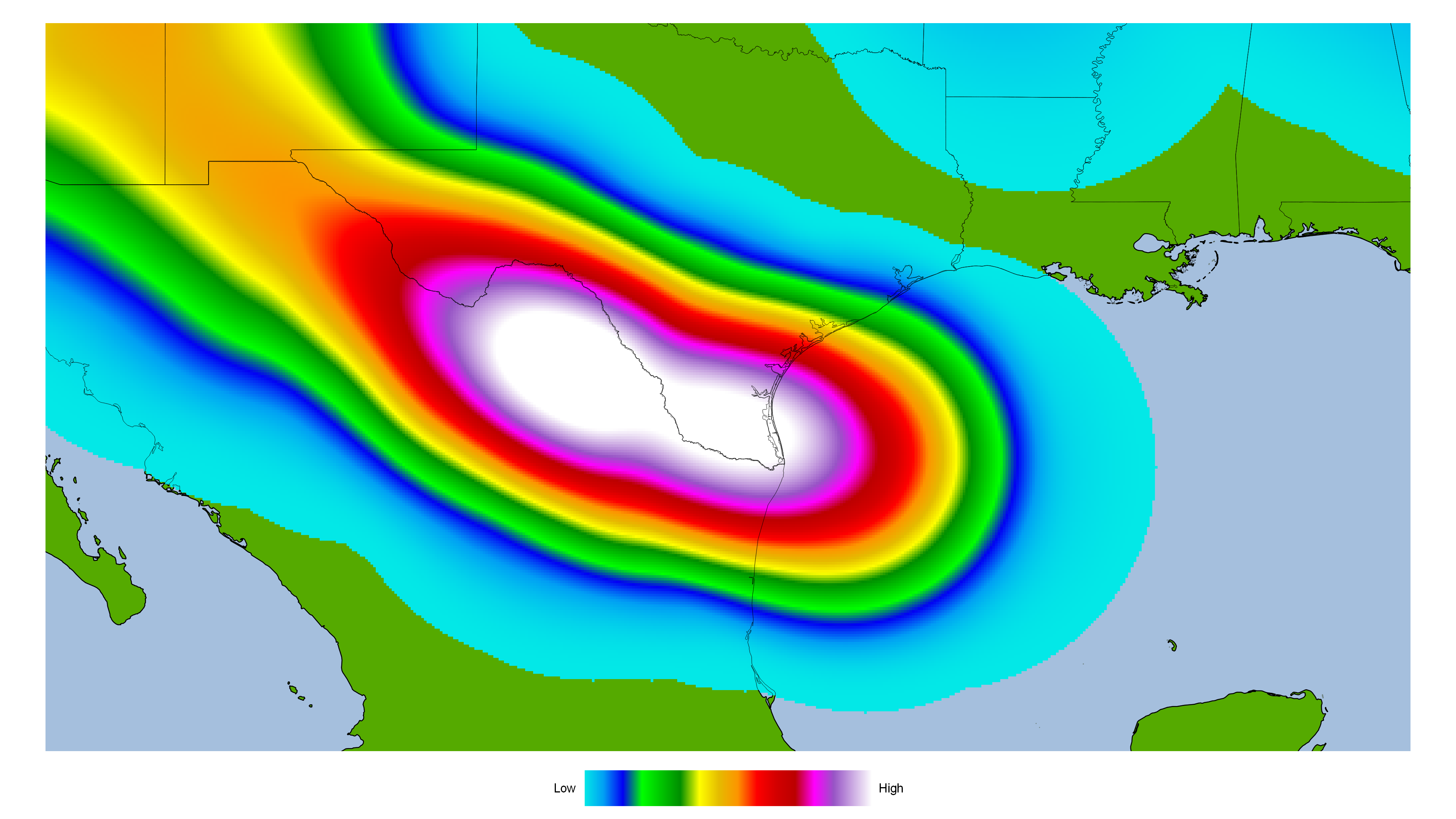
Most of the forecast models have Tropical Depression 9 heading towards South Texas. Some go far south as the mouth of Rio Grande River to far north as Corpus Christi. Most models have it going towards South Texas. There is a remote chance it could go towards Southeast Texas, but that is unlikely at this time. It currently remains a tropical depression. Here is the intensity forecast model from NCAR.
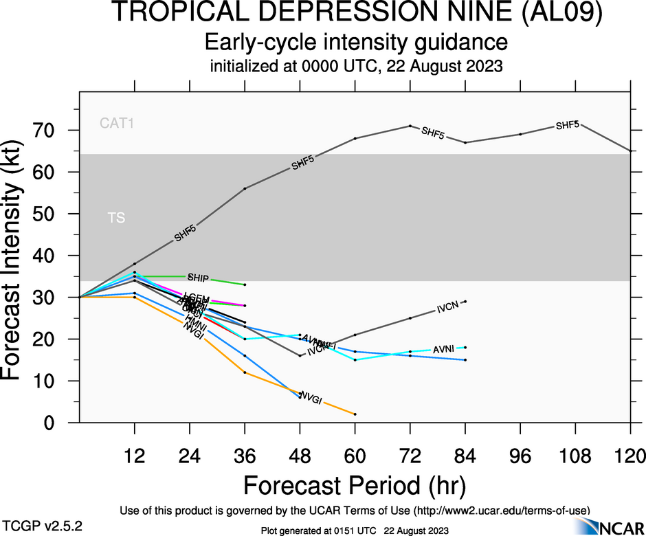
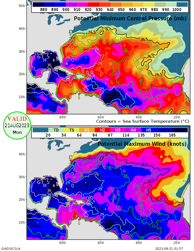
Most forecast models keep it as a tropical storm for a short time. One has it as a Category 1 hurricane, which keeps at as one far inland. The Gulf of Mexico is warm and can support Category 5 hurricane if conditions are right. Here is a Maximum Potential Hurricane Intensity for the Gulf of Mexico. It is courtesy of Center for Ocean-Land-Atmosphere (COLA).
I would not be surprised if Harold becomes a strong tropical storm or even a Category 1 hurricane before landfall. A major hurricane is unlikely as it is moving rather quickly. That would keep a lid on any further intensification. Tropical Depression 9 also has to deal with strong wind shear. Here is a wind shear map from CIMSS.
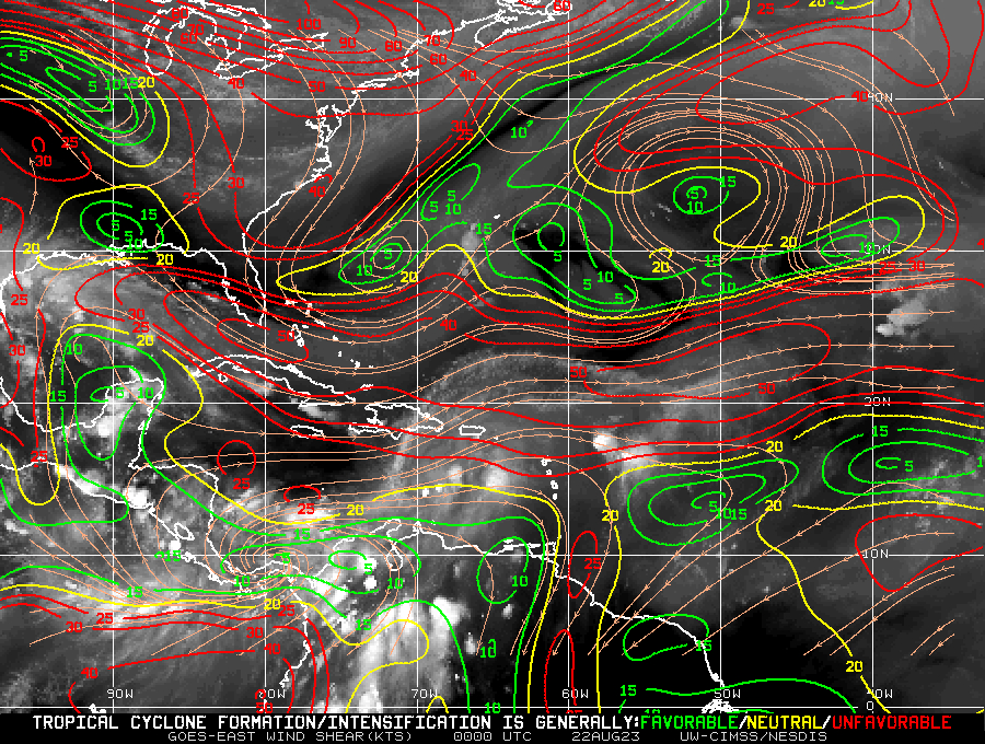
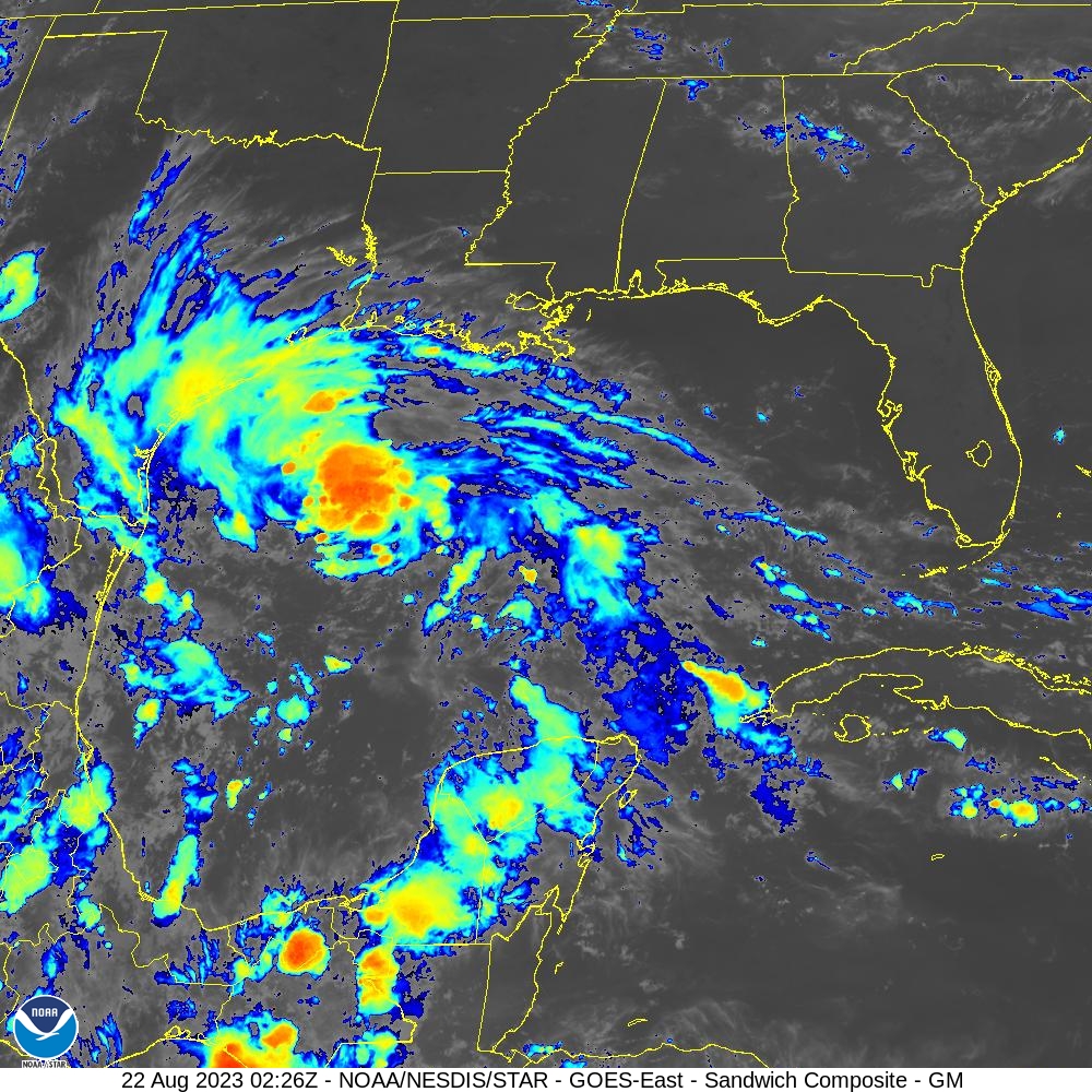
Wind shear and fast motion speed are likely to keep Harold as a tropical storm to Category 1 hurricane before landfall. Tropical cyclones have rapidly intensified right before making landfall on Texas. Something to not rule out with Harold. The satellite image of Tropical Depression 9 suggests it could be intensifying. There is also lightning near the center of future Harold. Here is a lightning flash map from GOES-East CONUS – Geostationary Lightning Mapper.
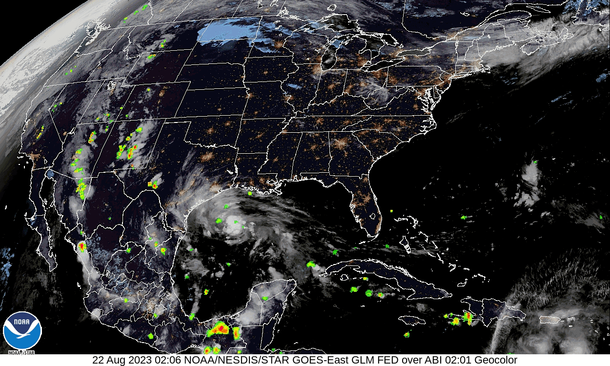
There was plenty of lightning near the center. It appears to have tapered off in terms of lighting. The circular shape also suggests it could be a tropical storm later tonight. The bandings around the tropical depression is also a sign Harold is about to form soon.
As with tropical systems, they often bring rain. How much rain will fall from future Harold? Here are rainfall forecast totals between August 21, 2023 to August 28, 2023. They are from Weather.US. The forecast models are:
GFS (American)
EURO (European)
ICON (Germany)
GDAPS/UM (South Korea)
JMA (Japanese)
GEM (Canadian)
CMA (China)
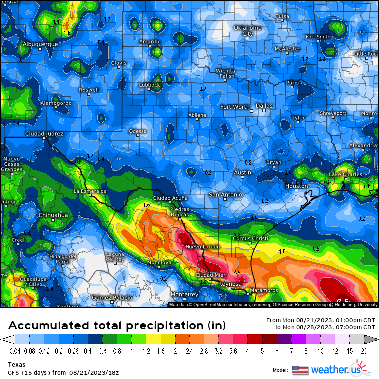
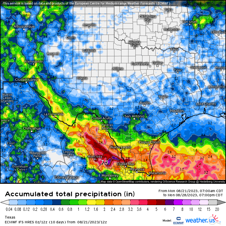
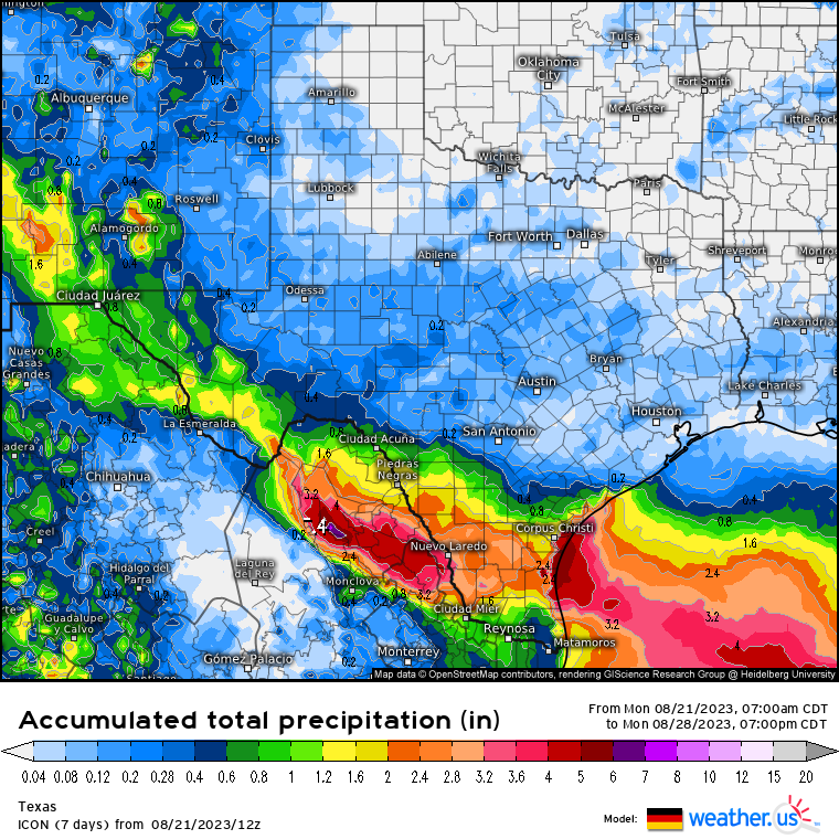
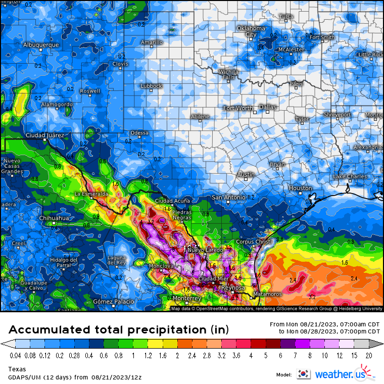
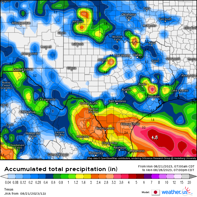
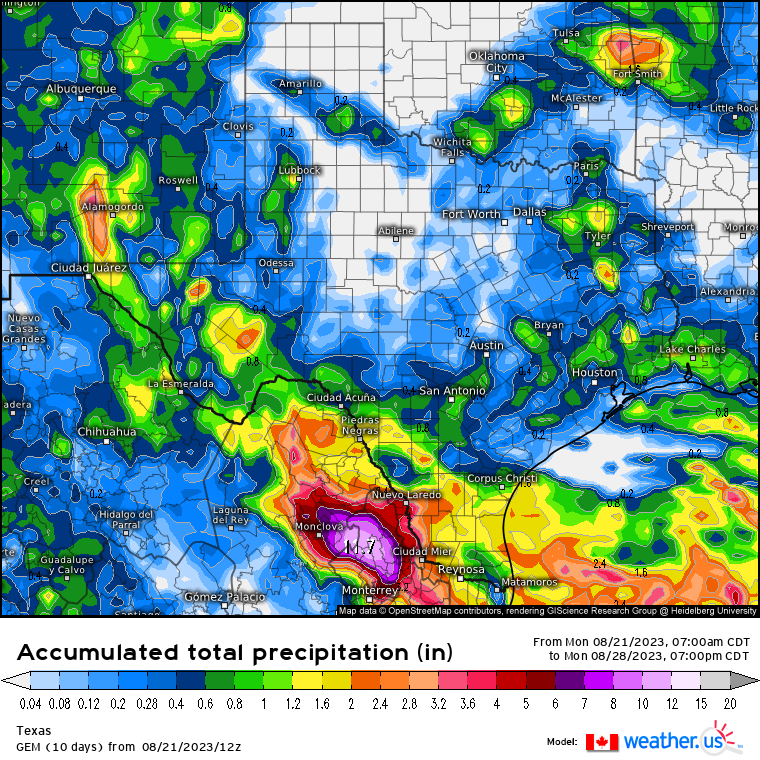
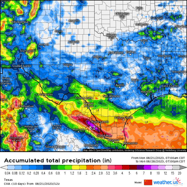
The Korean has the highest amount of 19.70 inches of rain. The Japanese has the lowest amount of 4.80 inches. Quite a wide range forecast in terms of rainfall. I ran a statistical analysis using PSPP. I look at rainfall total forecast.
| Mean | 9.40 |
| Median | 7.50 |
| Standard Deviation | 5.00 |
| 95% Confidence Interval Lower Bound | 4.78 |
| 95% Confidence Interval Upper Bound | 14.02 |
The mean rainfall total is 9.40 inches with median of 7.50 inches. The 95% Confidence Interval range are from 4.78 inches to 14.02 inches. It is probable the rainfall total will be somewhere between 4 to 14 inches of rain. There is a five percent chance that it is not in the true mean. It means it could be below 4 inches or over 14 inches. I can say with 95% confidence that the rainfall total is probably going to be somewhere between 4 to 14 inches of rain. More than likely, it is over 4 inches of rain.
I suspect most areas will see between 1 to 3 inches of rain. Some areas could get over 6 inches. I would not rule out 12 inches or higher once it is all over. All the forecast models do have rain over Southeast Texas. The Japanese has the highest with 4 inches of rain in the next 7 days.
Here is what I think will happen.
-Tropical Depression 9 will be Harold by morning.
-Tropical Depression 9/Harold is likely to make landfall on South Texas.
-Most areas in Texas will see rain.
